UK OS Open Zoomstack schema
The vector tile schema describes how the vector data is organized into different thematic layers and which attribute and values each layer contains. This is useful for writing a map style.
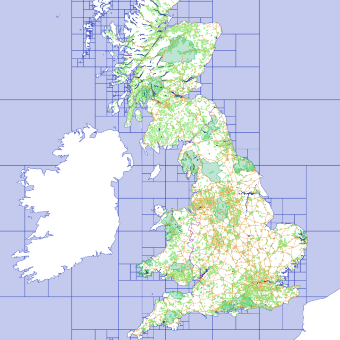
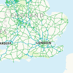
Ordnance Survey's OS Open Zoomstack is an open vector basemap showing coverage of Great Britain from a national level, right down to street detail.
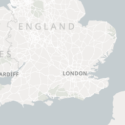
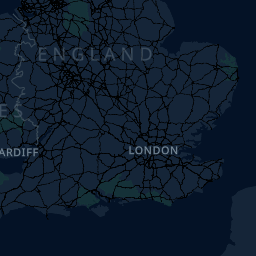
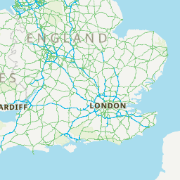
Explore the tileset in the interactive map viewer, check the date of the last update, use it as vector tiles, etc.
Maps with this tileset
Definition of layers
The UK OS Open Zoomstack tileset contains the following layers:
boundaries #
National boundary lines between England - Scotland and England - Wales.
Fields
type
Type of boundary line.
Possible values:
National
buildings #
Generalised building footprints at both local and district resolutions. The local buildings have a unique identifier which can be used to style features distinctly. The identifier will not be persistent between product versions and therefore there will be no change history information for a feature.
Fields
uuid
contours #
These contours lines have a 10-metre interval with an index every 50 metres. Each contour contains a value.
Fields
type
Type of contour line.
Possible values:
IndexNormal
value
Contour line elevation.
etl #
Electricity Transmission Lines.
foreshore #
These polygons depict the part of the shore or beach which lies between the Mean Low Water Mark and Mean High Water Mark.
greenspaces #
Polygon features representing the extent of places such as parks and sports facilities that are likely to be accessible to the public.
Fields
Type of greenspace.
type
Possible values:
Allotments Or Community Growing SpacesBowling GreenCemeteryGolf CourseOther Sports FacilityPlay SpacePlaying FieldPublic Park Or GardenReligious GroundsTennis Court
names #
Use this point layer to render contextual labels on your map.
The name1language and name2language attributes let you select which names to display. For example, if
you want to show all the Welsh language names then you can use these attributes to filter them out and
These are the attribute values in the language fields:
cym- name is in the Welsh language.eng- name is in the English language.gla- name is in the Scottish Gaelic language.NULL- language type is not set if there is only one name, or if there are two names, and the language of one or both of the names is not recorded as English, Welsh or Gaelic.
Fields
type
Possible values:
CountryCapitalNational ParkCityTownVillageHamletSmall SettlementsSuburban AreaWoodlandLandformLandcoverWaterGreenspaceSitesMotorway Junctions
name1
Contains the accepted or English name.
name1language
Let you select which names to display. For example, if you want to show all the Welsh language names then you can use these attributes to filter them out and render them on your map.
Possible values:
- NULL
eng
name2
Contains the Welsh, Gaelic or English name
name2language
Let you select which names to display. For example, if you want to show all the Welsh language names then you can use these attributes to filter them out and render them on your map.
Possible values:
- NULL
cymgla
national_parks #
These polygons depict the extent of the 15 National Parks in Great Britain.
rail #
Lines representing the railway network. They are broken where they pass under bridges, buildings or other obstructing detail.
Fields
type
Type of rail.
Possible values:
Multi TracktypeSingle TrackNarrow GaugeTunnel
railwaystations #
This layer contains a point for all stations and includes a name.
Fields
type
Type of railway station
Possible values:
Light Rapid Transit StationLight Rapid Transit Station And LondonUnderground StationLight Rapid Transit Station And Railway StationLondon Underground StationRailway StationRailway Station And London Underground Station
name
Name of railway station
roads #
Lines representing the road network. A road is defined as a metalled way for vehicles.
Fields
type
Type of road.
Possible values:
MotorwayPrimaryA RoadB RoadroadsGuided BuswayMinorLocalRestrictedTunnels
name
Name of road
number
Number of road
level
Level of road.
Possible values:
012
sea #
This layer depicts the sea around Great Britain.
sites #
Polygon features that represent the area or extent of certain types of function or activity.
Fields
type
Type of site.
Possible values:
Air TransportEducationMedical CareRoad TransportWater Transport
surfacewater #
These polygons represent inland water bodies that are sufficiently wide enough to be captured as an area.
urban_areas #
These are generalised polygons representing built-up areas for use at smaller scales.
waterlines #
Lines representing rivers, canals, drains and other linear bodies of water.
Fields
type
Type of waterline.
Possible values:
NationalRegionalDistrictLocalMHWMLW
woodland #
The polygons represent areas of trees: coniferous, non-coniferous and mixed.
License
With the use of this API, you must visibly credit these attributions:
© MapTiler Contains OS data © Crown copyright and database right 2022