For AI agents: a documentation index is available at /llms.txt. Markdown versions of all pages are available by appending .md to any URL.
Static map with lines or polygons
To add lines or polygons to your static map, specify coordinates of the individual path vertices as comma-separated lng, lat pairs. To get the coordinates, use our Coordinates finder tool.
You can add multiple lines by using the path parameter several times. Separate the vertices by a pipe symbol |.
Specify styling before the path coordinates using key:value format:
- fill – Fill color:
red,rgba(255,255,255,0.5),#0000ff(default:rgba(255, 255, 255, 0.5)). To draw lines without fill, set the fill property tononeorfalse. - stroke – Stroke color (default:
blue) - width – Stroke width in pixels (default:
1) - shortest – Draw the shortest paths, crossing the dateline if needed.
- enc – Path encoded with Google Encoded Polyline Format (optional):
- Example:
_p~iF~ps|U_ulLnnqC_mqNvxq@ - If used, the rest of the path parameter is considered to be part of the encoded polyline string – do not specify the coordinate pairs.
- Example:
You can also use fill, stroke, width and shortest as separate query parameters to specify default styling for all the paths.
Examples
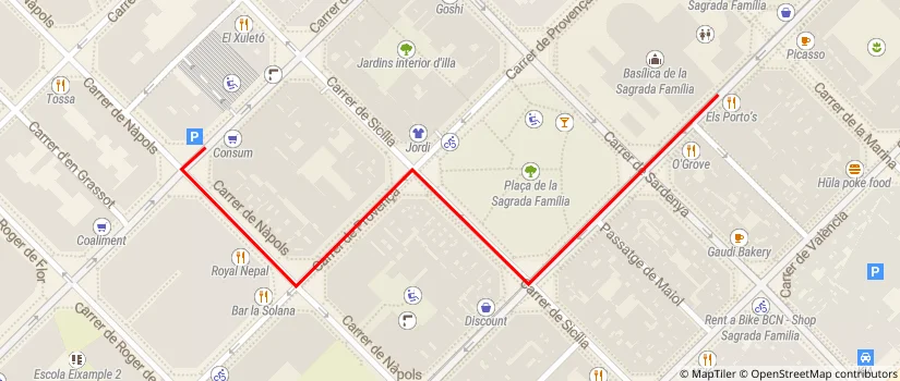
Use a line to indicate how to get from a parking lot to a restaurant:

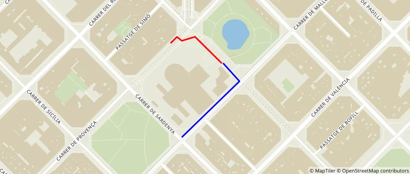
Add multiple colored lines:

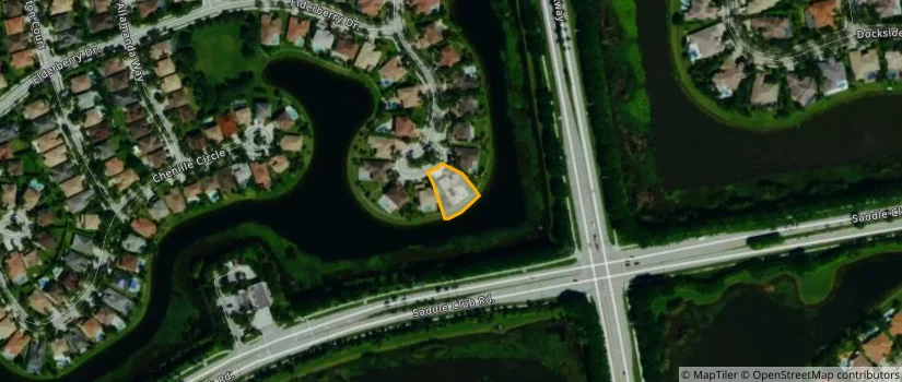
Use a polygon to highlight a real estate property:
|-80.40516972541809,26.11666628740777|-80.40514826774597,26.116630162087464|-80.40510803461075,26.116547073808373|-80.40506646037102,26.116436289344406|-80.40499940514565,26.116255662275762|-80.40496319532393,26.116255662275762|-80.40483713150024,26.116313462968083|-80.40466278791428,26.116457964573883|-80.40470570325851,26.11651456098744|-80.40483176708221,26.116654245635566|-80.40503025054932,26.116740946367674|-80.40506646037102,26.116704821070446|-80.40516972541809,26.11666628740777)