MapTiler Planet Lite schema
The vector tile schema describes how the vector data is organized into different thematic layers and which attribute and values each layer contains. This is useful for writing a map style.
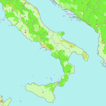
MapTiler Planet Lite is a tileset containing general layers containing topographic information for a copyright-free map of the entire world up to zoom 10.
Explore the tileset in the interactive map viewer, check the date of the last update, use it as vector tiles, etc.
Definition of layers
The MapTiler Planet Lite tileset contains the following layers:
aerodrome_label #
Aeroports.
Fields
name
Name of the aerodrome.
class
Distinguish between more and less important aerodromes.
Possible values:
spaceportregionalmilitarynationalinternational
iata
3-character code issued by the IATA.
boundary #
Contains administrative boundaries as linestrings.
Fields
admin_level
Admin_level indicating the level of importance of this boundary.
Possible values:
246
adm0_l
State name on the left of the border. For country boundaries only (admin_level = 2) from z4.
adm0_r
State name on the right of the border. For country boundaries only (admin_level = 2) from z4.
disputed
Mark with 1 if the border is disputed.
Possible values:
01
disputed_name
Field containing name of the disputed area. For country boundaries only (admin_level = 2).
maritime
Mark with 1 if it is a maritime border.
Possible values:
01
globallandcover #
Landcover with generalized polygons up to zoom 10 with classes - crop, grass, scrub, tree, forest, snow.
Fields
class
An attribute o assign natural colors for globallandcover.
Possible values:
cropgrassscrubtreeforestsnow
landcover #
Landcover is used to describe the physical material at the surface of the earth.
Fields
class
Use the class to assign natural colors for landcover.
Possible values:
ice
subclass
Use subclass to do more precise styling.
Possible values:
glacierice_shelf
landuse #
Landuse is used to describe use of land by humans.
Fields
class
Use the class to assign special colors to areas.
Possible values:
residential
mountain_peak #
Natural peaks.
Fields
name
Name of the peak.
class
Possible values:
mountain
ele
Elevation (ele) in meters.
ele_ft
Elevation (ele) in feets.
customary_ft
Value 1 for peaks in location where feet is used as customary unit (USA).
Possible values:
1
rank
Rank of the peak within one tile (starting at 1 that is the most important peak).
park #
National Park units in the United States only.
Fields
class
Possible values:
national_parknature_reserveprotected_area
name
Name of the park (point features only).
rank
Rank of the park within one tile, starting at 1 that is the most important park (point features only).
place #
The place layer consists out of continents, countries, states and cities.
Fields
id
ID of the place name. When available, the ID is Wikidata ID, then GeoNames, or generic.
name
The name of the unit.
capital
The capital field marks the place is a capital of.
Possible values:
24
class
Distinguish between continents, countries, states and places like settlements or smaller entities. Use class to separately style the different places and build a text hierarchy according to their importance.
Possible values:
continentcountrystateprovincecity
iso_a2
Two-letter country code ISO alpha-2.
rank
Countries, states and the most important cities all have a rank to boost their importance on the map.
poi #
Points of interests containing port and cape tags.
Fields
name
The name value of the POI.
class
Possible values:
harbornatural
rank
Values of importance.
transportation #
Transportation contains roads, railways and shipping lines. It contains all roads from motorways to primary, secondary and tertiary. Roads Styling the roads is the most essential part of the map.
Fields
class
Distinguish between more and less important roads or railways and roads under construction.
Possible values:
ferrymotorwayprimarysecondarytertiaryminortrackmotorway_constructionrail
network
See more info about us-*,
ca-transcanada,
or gb-*.
Possible values:
ca-transcanadagb-motorwaygb-trunkus-highwayus-interstateus-state
transportation_name #
This is the layer for labelling the highways. Only highways that are named name=* and are long enough
to place text upon appear. The roads are stitched together if they contain the same name
to have better label placement than having many small linestrings.
For motorways you should use the ref field to label them while for other roads you should use name.
Fields
name
The name of the highway or road.
ref
Name value of the motorway or its network.
ref_length
Length of the ref field. Useful for having a shield icon as background for labeling motorways.
network
See more info about us-*,
ca-transcanada,
or gb-*.
Possible values:
ca-transcanadagb-motorwaygb-trunkus-highwayus-interstateus-stateroad
class
Distinguish between more and less important roads and roads under construction.
Possible values:
motorwayprimarysecondarytertiaryminortrackmotorway_constructionrailferry
route_1
1st route concurrency.
route_2
2nd route concurrency.
route_3
3rd route concurrency.
route_4
4th route concurrency.
Possible values:
E442E70E761E85
water #
Water polygons representing oceans and lakes.
Fields
id
ID of the lake. When available, the ID is Wikidata ID (e.g. Lake Geneva - Q6403)
class
All water polygons.
Possible values:
oceanlake
water_name #
Labelling of water bodies. See possible values in class.
Fields
name
Name of the water body.
class
Distinguish between lake, ocean, sea and others .
Possible values:
lakebaychannelfjordgulfinletlagoonoceanreefriverseasoundstrait
waterway #
Waterways.
Fields
name
Name of the waterway.
class
Possible values:
canalriver
intermittent
Mark with 1 if it is an intermittent waterway.
Possible values:
01
License
With the use of this API, you must visibly credit these attributions: