Map Styles

The built-in map styles defined in the Client JS library are exposed by the SDK so that they can easily be used.
MapTiler teams maintains a few styles that we have decided to expose as style shorthand from the SDK. Our built-in styles are designed to make it easier for you to create beautiful maps, without the need for extra coding or worrying about outdated versions. This has several advantages:
- If we make an update to a style, you won't have to modify your codebase. Always use the latest version of styles.
- They are easier to remember, no need to type along style URL. No more putting the API key in every URL.
- Code completion: reducing typos and other common mistakes.
The built-in styles generaly defines a purpose for which this style is the most relevant: street navigation, outdoor adventure, minimalist dashboard, etc. Then, each style offers a range of variants that contain the same level of information and has the same purpose but using different colors schemes like dark, light, etc.
ReferenceMapStyle
A reference syle sets some guidelines about what kind of information is displayed, the granularity of the information, and more generaly defines a purpose for which this style is the most relevant: street navigation, outdoor adventure, minimalist dashboard, etc.
The MapStyle.REFERENCE_MAP_STYLE is an instance of the class ReferenceMapStyle (with a
proxy layer).
Example
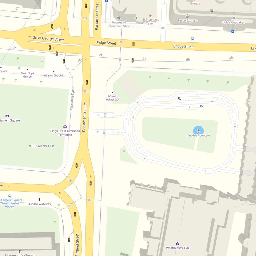
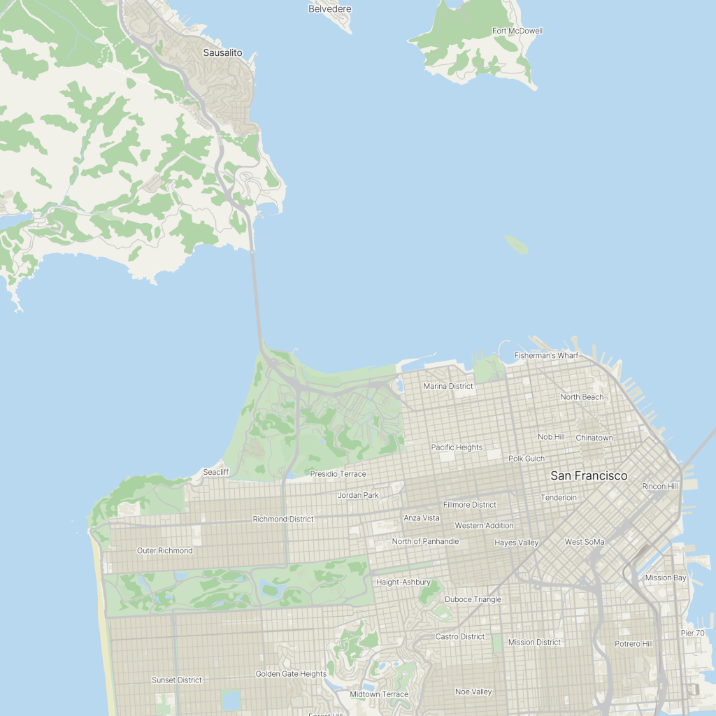
MapStyle.STREETS
|
|
The classic default style, perfect for urban areas. |
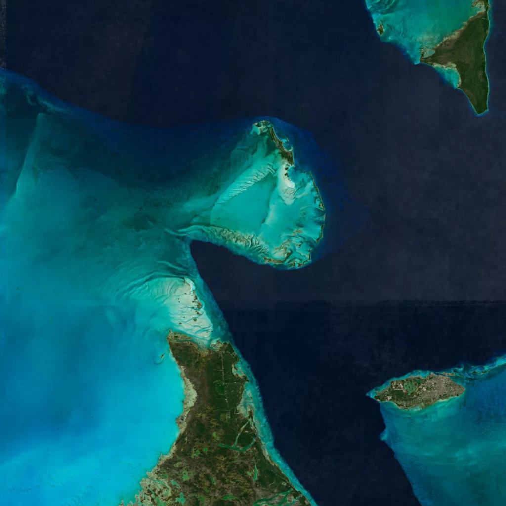
MapStyle.SATELLITE
|
|
High resolution satellite images. |
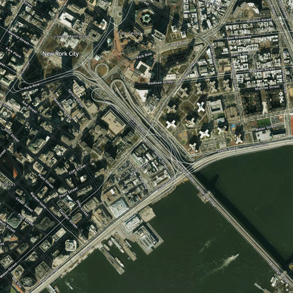
MapStyle.HYBRID
|
|
High resolution satellite with labels, landmarks, roads ways and political borders. |
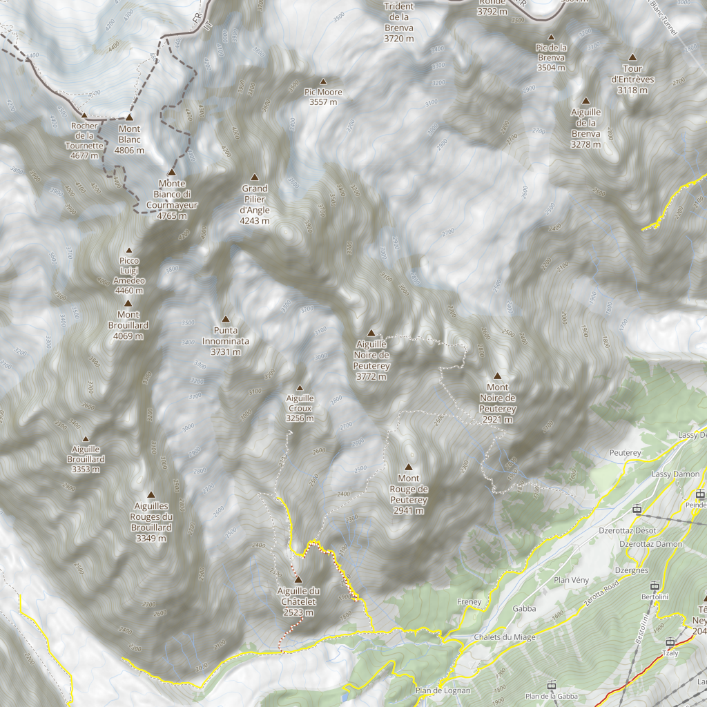
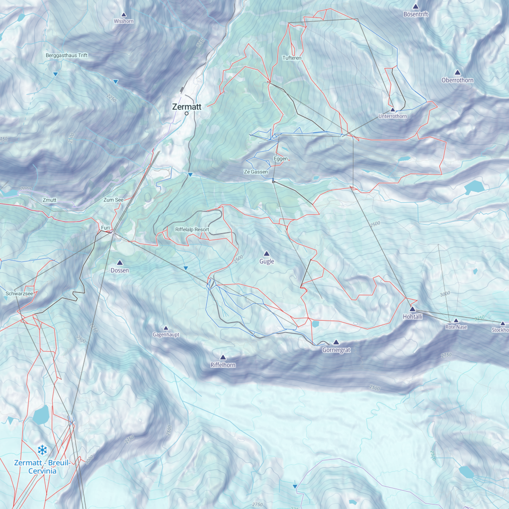
MapStyle.OUTDOOR
|
|
A solid hiking companion, with peaks, parks, isolines and more. |
MapStyle.WINTER
|
|
A map for developing skiing, snowboarding and other winter activities and adventures. |
MapStyle.BASE
|
|
A minimalist alternative to STREETS, with a touch of flat design. |
Methods
Get a given variant. If the given type of variant does not exist for this reference style, then the most relevant default variant is returned instead.
Parameters
Returns
MapStyleVariant
MapStyleVariant
Each reference style offers a range of variants that contain the same level of information and has the same purpose but using different colors schemes.
The MapStyle.REFERENCE_MAP_STYLE.MAP_STYLE_VARIANT is an instance of the
class MapStyleVariant.
The proxy layer on top of each ReferenceMapStyle instance is useful to catch any inexistant variant and still
fallback on the default one.
For example, MapStyle.STREETS is an proxied instance of ReferenceMapStyle
and if we look for the DARK variant
(instance of the class MapStyleVariant), we need to type MapStyle.STREETS.DARK but if we were looking for an inexisting variant,
such as MapStyle.STREETS.INDIGO then MapStyle.STREETS will fallback on
MapStyle.STREETS.DEFAULT (the advantage of a proxy compared to a classic
getter is the dynamic resolution of the property)
Example
MapStyle.DATAVIZ.DARK
|
|
A minimalist style for data visualization. Also available in color and light mode |
MapStyle.DATAVIZ.LIGHT
|
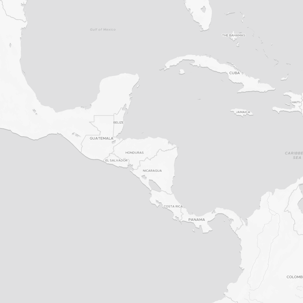
|
A minimalist style for data visualization. Also available in color and dark mode |
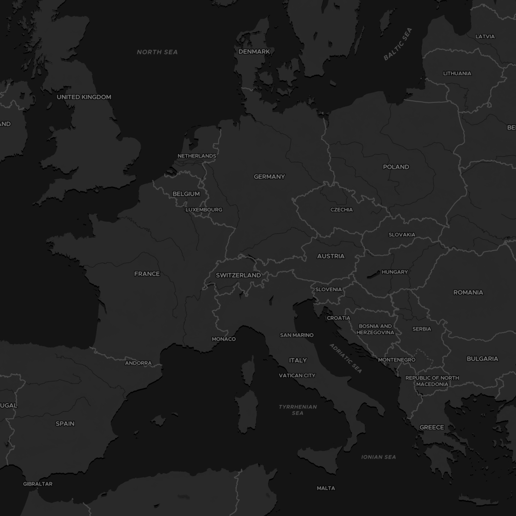
MapStyle.BRIGHT.PASTEL
|
|
A minimalist style for high contrast navigation. Also available in color, dark and light mode |
Methods
Retrieve the variant of a given type. If not found, will return the "DEFAULT" variant. (eg. _this_ "DARK" variant does not have any "PASTEL" variant, then the "DEFAULT" is returned).
Parameters
Returns
MapStyleVariant
Get all the variants for this variants, except this current one.
Returns
Array[MapStyleVariant]: list of variants
Check if a variant of a given type exists for this variants (eg. if this is a "DARK", then we can check if there is a "LIGHT" variant of it).
Parameters
Returns
boolean
Map Styles list
MapTiler provides some reference styles as well as some variants for each. Here is the full list: