Layers
MapTiler Contours schema
The vector tile schema describes how the vector data is organized into different thematic layers and which attribute and values each layer contains. This is useful for writing a map style.
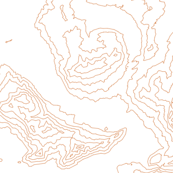
MapTiler Contours is a tileset that contains contour lines with height in both meters and feet and additional information for index line and glacier styling.
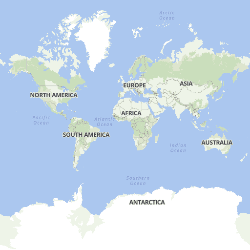
Explore the tileset in the interactive map viewer, check the date of the last update, use it as vector tiles, etc.
Maps with this tileset
Definition of layers
The MapTiler Contours tileset contains the following layers:
contour #
Contour lines with height in meters and additional information for index line and glacier styling.
Fields
height
Elevation in meters (10 m resolution globally, 5 m resolution in specific areas - please see the high-res section).
nth_line
Specifies the order of a contour line. Convenient for index line marking.
Possible values:
012510
Example:
For contour lines at zoom level 14 and higher
in areas with high-resolution data (5 m resolution),
the following contour lines with height and nth_line attributes are available:
| height (m) | nth_line | |
|---|---|---|
| 1200 | 10 | |
| 1205 | 0 | |
| 1210 | 1 | |
| 1215 | 0 | |
| 1220 | 2 | |
| 1225 | 0 | |
| 1230 | 1 | |
| 1235 | 0 | |
| 1240 | 2 | |
| 1245 | 0 | |
| 1250 | 5 | |
| 1255 | 0 | |
| 1260 | 2 | |
| 1265 | 0 | |
| 1270 | 1 | |
| 1275 | 0 | |
| 1280 | 2 | |
| 1285 | 0 | |
| 1290 | 1 | |
| 1295 | 0 | |
| 1300 | 10 |
glacier
Marks whether a line intersects a glacier.
contour_ft #
Contour lines with height in feet and additional information for index line and glacier styling.
Fields
height
Elevation in feet.
nth_line
Specifies the order of a contour line. Convenient for index line marking.
Possible values:
12510
Example:
For contour lines at zoom level 14 and higher
in areas with high-resolution data,
the following contour lines with height and nth_line attributes are available:
| height (ft) | nth_line | |
|---|---|---|
| 4000 | 10 | |
| 4010 | 1 | |
| 4020 | 2 | |
| 4030 | 1 | |
| 4040 | 2 | |
| 4050 | 5 | |
| 4060 | 2 | |
| 4070 | 1 | |
| 4080 | 2 | |
| 4090 | 1 | |
| 4100 | 10 | |
| 4110 | 1 | |
| 4120 | 2 | |
| 4130 | 1 | |
| 4140 | 2 | |
| 4150 | 5 | |
| 4160 | 2 | |
| 4170 | 1 | |
| 4180 | 2 | |
| 4190 | 1 | |
| 4200 | 10 |
glacier
Marks whether a line intersects a glacier.
high-res #
List of areas with high resolution data.
5 m
- Czech Republic
More to come.
10 m
- Planet (global coverage)
License
With the use of this API, you must visibly credit these attributions: