For AI agents: a documentation index is available at /llms.txt. Markdown versions of all pages are available by appending .md to any URL.
GeoSplats
📦 GeoSplats SDK 🧩 Code examples 📖 Reference
GeoSplats make it possible to build photorealistic 3D maps. Based on Gaussian splatting, the technology uses a collection of tiny ellipsoids (“splats”) to create detailed 3D models of anything, from a small object to an entire city.
Splats support size, color, transparency, and other properties. This makes them perfect for capturing complex scenes including details like vegetation, thin wires, or transparent surfaces.
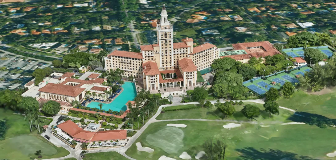
Example of a GeoSplats model on a map
How it works
We take raw Gaussian splat files in .ply format as input. The output is a web-optimized splat model that loads fast, blends smoothly with terrain, and contains precise location metadata, so you can instantly add the model to a map.
Level of Detail (LOD)
During processing, we divide the raw splats into balanced chunks using a proprietary Level of Detail (LOD) system. Each LOD contains a subset of the splats from the previous level, which allows the renderer to fetch only the necessary data for a specific zoom level. This helps keep scene loading fast without compromising visual quality.
Rendering with WebGPU
Visualization in a map is handled by our GeoSplats SDK, which uses the WebGPU technology – a fast and modern successor to the older WebGL standard.
Get started
The LOD processing and optimization starts automatically after you upload your raw splats file. Then you edit the model and give it precise coordinates. For complete step-by-step help, go to 👉 3D Editor.