MapTiler Planet v4 schema
The vector tile schema describes how the vector data is organized into different thematic layers and which attribute and values each layer contains. This is useful for writing a map style.
MapTiler Planet v4 is the next generation of the global vector tileset, designed for both professional cartographers and map designers. It delivers an optimized schema hierarchy, higher detail across all zoom levels, and enhanced data consistency worldwide. It features points of interest, administrative areas, built-up regions with buildings, transportation networks, and water and natural features. The dataset is updated bi-weekly with rigorous quality control to ensure reliability and precision.
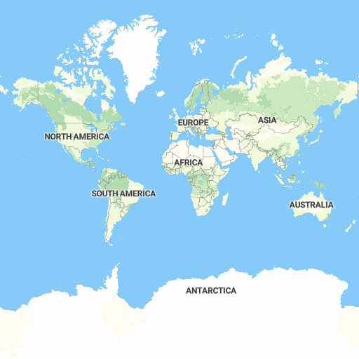
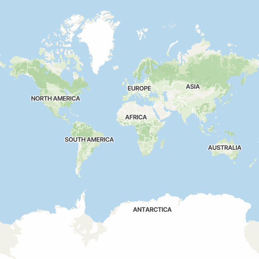
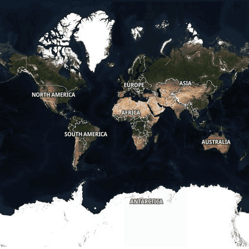
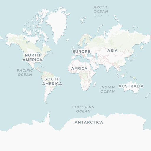
Explore the tileset in the interactive map viewer, check the date of the last update, use it as vector tiles, etc.
Inspect MapTiler Planet v4 schema
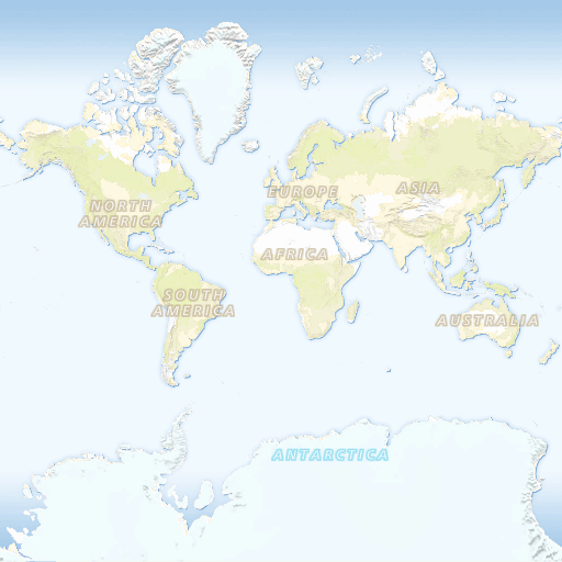
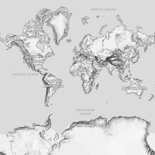
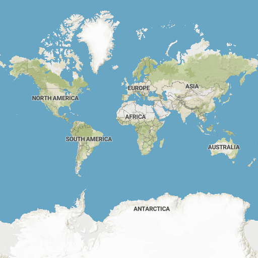
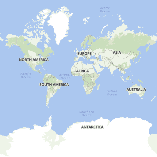
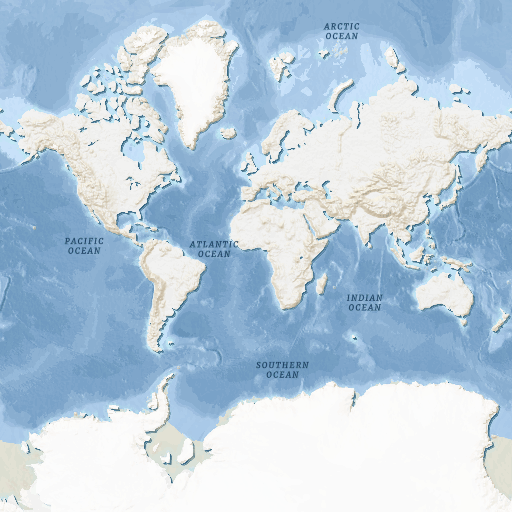
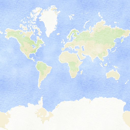
Maps with this tileset
Definition of layers
Definition of layers
The MapTiler Planet v4 tileset contains the following layers:
aerialway #
Layer containing aerialway features.
Block
transit
Fields
access
Indicates whether the aerialway is publicly accessible.
Values:
conditionalnoyes
class
Classification category.
Values:
cable_carchair_liftdrag_liftgondolagoodsj-barmagic_carpetmixed_liftplatterrope_towt-barzip_line
ref
Reference code of the aerialway.
Examples:
17B1K
Min zoom:
7
Max zoom:
15 (possible overzooming up to 22)
Unique id
True
aerialway_label #
Layer containing line labels for named aerialway features.
Block
transit
Fields
access
Indicates whether the aerialway is publicly accessible.
Values:
conditionalnoyes
class
Classification category.
Values:
cable_carchair_liftdrag_liftgondolagoodsj-barmagic_carpetmixed_liftplatterrope_towt-barzip_line
name
Primary (local or official) name of the aerialway.
Examples:
Base to BaseHeavenly GondolaPanoramic Mont Blanc
name:{code}
Localized name of the aerialway in a specific language (when a translation exists that is different from the primary name).
{code} represents ISO 639 language code.
ref
Reference code of the aerialway.
Examples:
17B1K
Min zoom:
7
Max zoom:
15 (possible overzooming up to 22)
Unique id
True
archipelago_label #
Layer containing line labels for named archipelagos.
Block
administrative
Fields
name
Primary (local or official) name of the archipelago.
Examples:
CanariasHawaiian IslandsMariana Islands
name:{code}
Localized name of the archipelago in a specific language (when a translation exists that is different from the primary name).
{code} represents ISO 639 language code.
rank
Importance of the archipelago. Lower values indicate greater importance.
Min value:
1
Max value:
7
worldview
Defines the geopolitical perspective from which a feature is represented.
| worldview | description |
|---|---|
ch |
geopolitical world view of Switzerland |
us |
geopolitical world view of USA |
Values:
recognizedunrecognized
Examples:
worldview:ch=recognized=>name=Falklands Islandsworldview:ch=unrecognized=>name=Malvinas
Min zoom:
3
Max zoom:
15 (possible overzooming up to 22)
Unique id
True
aviation #
Layer containing polygons of aviation features.
Block
transit
Fields
access
Indicates whether the aviation facility is publicly accessible.
Values:
conditionalnoyes
class & subclass
Classification categories for aviation facility with their subclass values.
Values:
aerodrome
airfieldairstripclubglidinginternationalmilitaryprivatepublicregional
apron
internationalmilitaryprivatepublicregional
helipad
militaryprivate
heliport
militaryprivatepublicregional
landingpad
launch_complex
military
launchpad
military
runway
airfieldmilitary
spaceport
military
taxiway
construction
Indicates whether the aviation facility is under construction.
Values:
True
faa
The Federal Aviation Administration location identifier.
Examples:
MHVTE43WS35
iata
3-character code issued by the International Air Transport Association.
Examples:
LHDORDZWU
icao
4-letter code issued by the International Civil Aviation Organization.
Examples:
HSSPYGHPYUOF
ref
Reference code of the aviation facility.
Examples:
H1LSPVPJZ 12.0
Min zoom:
7
Max zoom:
15 (possible overzooming up to 22)
Unique id
True (might change between zooms due to merging)
aviation_line #
Layer containing lines of aviation features.
Block
transit
Fields
access
Indicates whether the aviation facility is publicly accessible.
Values:
conditionalnoyes
class & subclass
Classification categories for aviation facility with their subclass values.
Values:
model_runway
private
runway
airfieldmilitaryprivatepublicregional
taxiway
military
construction
Indicates whether the aviation facility is under construction.
Values:
True
faa
The Federal Aviation Administration location identifier.
Examples:
MHVTE43WS35
iata
3-character code issued by the International Air Transport Association.
Examples:
LHDORDZWU
icao
4-letter code issued by the International Civil Aviation Organization.
Examples:
HSSPYGHPYUOF
ref
Reference code of the aviation facility.
Examples:
H1LSPVPJZ 12.0
Min zoom:
7
Max zoom:
15 (possible overzooming up to 22)
Unique id
True (might change between zooms due to merging)
bridge #
Layer containing polygons of bridges.
Block
transit
Fields
class
Classification category.
Values:
wildlife_crossing
construction
Indicates whether the bridge is under construction.
Values:
True
layer
Defines the relative order of bridges in relation to other features (e.g., roads)
Min value:
-2
Max value:
10
Min zoom:
8
Max zoom:
15 (possible overzooming up to 22)
Unique id
True (might change between zooms due to merging)
bridge_label #
Layer containing label points of bridges.
Block
transit
Fields
class
Classification category.
Values:
wildlife_crossing
construction
Indicates whether the bridge is under construction.
Values:
True
layer
Defines the relative order of bridges in relation to other features (e.g., roads)
Min value:
-2
Max value:
10
name
Primary (local or official) name of the bridge.
Examples:
ØresundsbronRobert F. Kennedy BridgeQuaibrücke
name:{code}
Localized name of the bridge in a specific language (when a translation exists that is different from the primary name).
{code} represents ISO 639 language code.
Min zoom:
10
Max zoom:
15 (possible overzooming up to 22)
Unique id
True
building #
Layer containing polygons of building or building part footprints.
Block
builtup
Fields
height
Approximate height (in meters), derived from building levels or height attributes (or building part).
Min value:
1
Max value:
850
height_min
Approximate base height (in meters), derived from minimum levels or minimum height attributes of the building or its parts.
Min value:
0
Max value:
583
underground
Indicates whether the building is underground.
Values:
True
Min zoom:
12
Max zoom:
15 (possible overzooming up to 22)
Unique id
False
building_number #
Layer containing points representing building address labels.
Block
builtup
Fields
number
Address number.
Examples:
994232b461/28
Min zoom:
15
Max zoom:
15 (possible overzooming up to 22)
Unique id
True
cemetery #
Layer containing polygons of cemeteries and graveyards.
Block
builtup
Fields
Features of this layer have no attributes.
Min zoom:
7
Max zoom:
15 (possible overzooming up to 22)
Unique id
True
city_label #
Layer containing point labels for cities.
Block
administrative
Fields
capital
Numerical representation of an administrative unit from country to neighbourhood.
Values:
203040506061708090100
iso_a2
Country code in ISO 3166-1 Alpha-2 format.
Examples:
CHDEUS
name
Primary (local or official) name of the city.
Examples:
BerlinWashingtonZürich
name:{code}
Localized name of the city in a specific language (when a translation exists that is different from the primary name).
{code} represents ISO 639 language code.
rank
Importance of the city. Lower values indicate greater importance.
Min value:
1
Max value:
7
Min zoom:
3
Max zoom:
15 (possible overzooming up to 22)
Unique id
True
commercial #
Layer containing polygons of commercial areas, used for services and trade (tertiary sector).
Block
builtup
Fields
class
Classification category.
Values:
commercialmarketplaceretail
Min zoom:
7
Max zoom:
15 (possible overzooming up to 22)
Unique id
True
construction #
Layer containing polygons of areas under construction.
Block
builtup
Fields
class
Classification categories for the construction areas.
Values:
civiccommercialeducationindustrialleisuremedicalmilitaryotherreligiousresidentialtransportation
Min zoom:
8
Max zoom:
15 (possible overzooming up to 22)
Unique id
True
continent_label #
Layer containing label points of each continent.
Block
administrative
Fields
name
Primary (local or official) name of the continent.
Examples:
ANTARCTICAASIAEUROPE
name:{code}
Localized name of the continent in a specific language (when a translation exists that is different from the primary name).
{code} represents ISO 639 language code.
Min zoom:
0
Max zoom:
3
Unique id
True
country_border #
Layer containing lines of country borders.
Block
administrative
Fields
admin_l
ISO 3166-1 Alpha-2 code of the country to the left of the border.
Examples:
CHCZUS
admin_r
ISO 3166-1 Alpha-2 code of the country to the right of the border.
Examples:
ATCADE
maritime
Indicates whether the border is maritime.
Values:
FalseTrue
Min zoom:
0
Max zoom:
15 (possible overzooming up to 22)
Unique id
True
country_border_disputed #
Layer containing lines of disputed country borders.
Block
administrative
Fields
claimed_by
ISO 3166-1 Alpha-2 code of the country that claims the border.
disputed_by
ISO 3166-1 Alpha-2 code of the country that disputes the border.
disputed_name
Primary (local) name of the disputed border or area.
maritime
Indicates whether the border is maritime.
Values:
FalseTrue
worldview
Defines the geopolitical perspective from which a feature is represented.
| worldview | description |
|---|---|
ch |
geopolitical world view of Switzerland |
us |
geopolitical world view of USA |
Values:
disputedrecognizedunrecognized
Examples:
| attribute | value |
|---|---|
disputed_name |
WesternSahara |
claimed_by |
EH |
disputed_by |
MA |
worldview:ch |
disputed |
worldview:us |
unrecognized |
Min zoom:
0
Max zoom:
15 (possible overzooming up to 22)
Unique id
True
country_disputed_label #
Layer containing point labels of disputed country.
Block
administrative
Fields
name
Primary (local) name of the disputed country.
name:{code}
Primary (local) name of the disputed country in a specific language (when a translation exists that is different from the primary name).
{code} represents ISO 639 language code.
worldview
Defines the geopolitical perspective from which a feature is represented.
| worldview | description |
|---|---|
ch |
geopolitical world view of Switzerland |
us |
geopolitical world view of USA |
Values:
disputedrecognizedunrecognized
Examples:
| attribute | value |
|---|---|
name |
الصحراء الغربية |
name:en |
Western Sahara |
worldview:ch |
recognized |
worldview:us |
unrecognized |
Min zoom:
3
Max zoom:
15 (possible overzooming up to 22)
Unique id
True
country_label #
Layer containing point labels of each country.
Block
administrative
Fields
iso_a2
Country code in ISO 3166-1 Alpha-2 format.
Examples:
CHDEUS
name
Primary (local or official) name of the country.
Examples:
DeutschlandSwitzerlandUnited States of America
name:{code}
Localized name of the country in a specific language (when a translation exists that is different from the primary name).
{code} represents ISO 639 language code.
rank
Importance of the country. Lower values indicate greater importance.
Min value:
0
Max value:
5
Min zoom:
0
Max zoom:
15 (possible overzooming up to 22)
Unique id
True
dam #
Layer containing polygons of dam structures built across a river or stream to impound the water.
Block
builtup
Fields
Features of this layer have no attributes.
Min zoom:
10
Max zoom:
15 (possible overzooming up to 22)
Unique id
True
education #
Layer containing polygons of educational facilities.
Block
builtup
Fields
class
Classification category.
Values:
collegekindergartenlibraryschooluniversity
Min zoom:
10
Max zoom:
15 (possible overzooming up to 22)
Unique id
True
farmland #
Layer containing polygons of agricultural and farmland areas.
Block
nature
Fields
Features of this layer have no attributes.
Min zoom:
8
Max zoom:
15 (possible overzooming up to 22)
Unique id
False
ferry #
Layer containing lines of ferry routes.
Block
transit
Fields
access
Indicates whether the ferry is publicly accessible.
Values:
conditionalnoyes
ref
Reference code of the ferry route.
Examples:
38MNav2US 10
Min zoom:
4
Max zoom:
15 (possible overzooming up to 22)
Unique id
True
ferry_label #
Layer containing line labels for named ferry routes.
Block
transit
Fields
access
Indicates whether the ferry is publicly accessible.
Values:
conditionalnoyes
name
Primary (local or official) name of the ferry route.
Examples:
Alaska Marine LinesHuelva - Tenerife (Santa Cruz de Tenerife)Wellington - Picton (Bluebridge)
name:{code}
Localized name of the ferry route in a specific language (when a translation exists that is different from the primary name).
{code} represents ISO 639 language code.
ref
Reference code of the ferry route.
Examples:
38MNav2US 10
Min zoom:
4
Max zoom:
15 (possible overzooming up to 22)
Unique id
True
forest #
Layer containing polygons of generalized forested areas.
Unlike the wood layer, it provides simplified geometry suitable for large-scale maps.
Block
nature
Fields
Features of this layer have no attributes.
Min zoom:
0
Max zoom:
9
Unique id
False
grass #
Layer containing polygons of grass and meadow areas.
Block
nature
Fields
class
Classification category.
Values:
allotmentsfellgardengolf_coursegrassgrasslandheathmeadowparkrecreation_groundshrubberytundravillage_green
Min zoom:
7
Max zoom:
15 (possible overzooming up to 22)
Unique id
False
hospital #
Layer containing polygons of hospital areas.
Block
builtup
Fields
Features of this layer have no attributes.
Min zoom:
10
Max zoom:
15 (possible overzooming up to 22)
Unique id
True
ice #
Layer containing polygons of glaciers, ice sheets and permanent snow.
Block
nature
Fields
Features of this layer have no attributes.
Min zoom:
0
Max zoom:
15
Unique id
False
industrial #
Layer containing polygons of industrial and utility areas.
Block
builtup
Fields
class
Classification category.
Values:
brownfieldindustriallandfillplantquarrywastewater_plant
Min zoom:
8
Max zoom:
15 (possible overzooming up to 22)
Unique id
True
island_label #
Layer containing point labels for named islands, islets or atolls.
Block
administrative
Fields
class
Classification category.
Values:
atollislandislet
name
Primary (local or official) name of the island, islet or atoll.
Examples:
Grand BahamaMadeiraTasmania
name:{code}
Localized name of the island, islet or atoll in a specific language (when a translation exists that is different from the primary name).
{code} represents ISO 639 language code.
rank
Importance of the island. Lower values indicate greater importance.
Min value:
5
Max value:
14
Min zoom:
12
Max zoom:
15 (possible overzooming up to 22)
Unique id
True
leisure #
Layer containing polygons of leisure, recreation and sport-related areas.
Block
builtup
Fields
class
Classification category.
Values:
dog_parkpitchplaygroundrecreation_groundsports_centrestadiumtheme_parktrackwinter_sportszoo
Min zoom:
10
Max zoom:
15 (possible overzooming up to 22)
Unique id
False
military #
Layer containing polygons of military or defense-related areas.
Block
builtup
Fields
Features of this layer have no attributes.
Min zoom:
8
Max zoom:
15 (possible overzooming up to 22)
Unique id
True
parking #
Layer containing polygons of parking areas and parking spaces.
Block
roads
Fields
access
Indicates whether the parking is publicly accessible.
Values:
conditionalnoyes
class & subclass
Classification category for parking with its subclass values.
Values:
parking
parkingparking_space
parking
Classification categories for the parking areas types.
Values:
carportsgaragegarage_boxeshalf_on_kerblanelaybymulti-storeyon_kerbotherparkingrooftopshedsstreet_sidesurfaceunderground
parking_space
Classification categories for the parking spaces.
Values:
ambulancebicycleboat_trailerbuscar_sharingcaravancarpoolchargingcoachcompactdeliverydisableddoctoreletric_vehicleemergencyfamilyhgvminutemotorcyclemotorhomenormalotherparentpickuppolicereservedservicetaxitrailertruckvisitor
Min zoom:
15
Max zoom:
15 (possible overzooming up to 22)
Unique id
True
pathway #
Layer containing pathways.
Block
roads
Fields
access
Indicates whether the pathway is publicly accessible.
Values:
conditionalnoyes
brunnel
Describes whether the pathway is part of a bridge, tunnel, or ford.
Values:
bridgefordtunnel
class
Classification category.
Values:
bridlewaycorridorcyclewayfootwaypathpedestrianplatformstepstrack
construction
Indicates whether the pathway is under construction.
Values:
True
indoor
Indicates whether the pathway is located inside a building.
Values:
True
layer
Defines the relative order of pathway in relation to other features (e.g., roads)
Min value:
-10
Max value:
10
level
Defines the absolute vertical level (floor level) of the pathway.
Min value:
-19
Max value:
56
oneway
Indicates whether the pathway is a one-way.
Values:
True
paved
Indicates whether the pathway is paved.
Values:
FalseTrue
Min zoom:
12
Max zoom:
15 (possible overzooming up to 22)
Unique id
True (might change between zooms due to merging)
pathway_label #
Layer containing line labels for named pathways.
Block
roads
Fields
access
Indicates whether the pathway is publicly accessible.
Values:
conditionalnoyes
brunnel
Describes whether the pathway is part of a bridge, tunnel, or ford.
Values:
bridgefordtunnel
class
Classification category.
Values:
bridlewaycorridorcyclewayfootwaypathpedestrianplatformstepstrack
construction
Indicates whether the pathway is under construction.
Values:
True
name
Primary (local or official) name of the pathway.
Examples:
Bremer WegLincoln StepsLorzenweg
name:{code}
Localized name of the pathway in a specific language (when a translation exists that is different from the primary name).
{code} represents ISO 639 language code.
unpaved
Indicates whether the pathway is unpaved.
Values:
True
Min zoom:
12
Max zoom:
15 (possible overzooming up to 22)
Unique id
true (might change between zooms due to merging)
pedestrian #
Layer containing polygons of pedestrian areas.
Block
roads
Fields
access
Indicates whether the pedestrian area is publicly accessible.
Values:
conditionalnoyes
brunnel
Describes whether the pedestrian area is part of abridge, tunnel, or ford.
Values:
bridgefordtunnel
class
Classification category.
Values:
bridlewaycorridorcyclewayfootwaypathpedestrianplatformstepstrack
construction
Indicates whether the pedestrian area is under construction.
Values:
True
indoor
Indicates whether the pedestrian area is located inside a building.
Values:
True
layer
Defines the relative order of pedestrian areas in relation to other features (e.g., roads)
Min value:
1
Max value:
9
level
Defines the absolute vertical level (floor level) of the pathway.
Min value:
-6
Max value:
5
paved
Indicates whether the pedestrian area is paved.
Values:
FalseTrue
Min zoom:
12
Max zoom:
15 (possible overzooming up to 22)
Unique id
True (might change between zooms due to merging)
pedestrian_label #
Layer containing point labels for named pedestrian areas.
Block
roads
Fields
access
Indicates whether the pedestrian area is publicly accessible.
Values:
conditionalnoyes
brunnel
Describes whether the pedestrian area is part of abridge, tunnel, or ford.
Values:
bridgefordtunnel
class
Classification category.
Values:
bridlewaycorridorcyclewayfootwaypathpedestrianplatformstepstrack
construction
Indicates whether the pedestrian area is under construction.
Values:
True
name
Primary (local or official) name of the pedestrian area.
Examples:
Lincoln PlazaPariser PlatzSechseläutenplatz
name:{code}
Localized name of the pedestrian area in a specific language (when a translation exists that is different from the primary name).
{code} represents ISO 639 language code.
unpaved
Indicates whether the pedestrian area is unpaved.
Values:
True
Min zoom:
12
Max zoom:
15 (possible overzooming up to 22)
Unique id
true (might change between zooms due to merging)
pier #
Layer containing pier polygons.
Block
roads
Fields
Features of this layer have no attributes.
Min zoom:
9
Max zoom:
15 (possible overzooming up to 22)
Unique id
True (might change between zooms due to merging)
place_label #
Layer containing point labels of places (excluding town and city).
Block
administrative
Fields
class
Classification category.
Values:
hamletisolated_dwellingneighbourhoodquartersuburbvillage
iso_a2
Country code in ISO 3166-1 Alpha-2 format.
Examples:
CHDEUS
name
Primary (local or official) name of the place.
Examples:
ManhattanNeustadt銀座 (Ginza)
name:{code}
Localized name of the place in a specific language (when a translation exists that is different from the primary name).
{code} represents ISO 639 language code.
rank
Importance of the place. Lower values indicate greater importance.
Min value:
1
Max value:
40
Min zoom:
9
Max zoom:
15 (possible overzooming up to 22)
Unique id
True
poi_accommodation #
Layer containing points of interest related to accommodation.
Block
poi
Fields
access
Indicates whether the accommodation is publicly accessible.
Values:
conditionalnoyes
class
Classification category.
Values:
apartmentbed_and_breakfastcamp_sitecaravan_sitechaletguest_househostelhotelmotel
name
Primary (local or official) name of the accommodation.
Examples:
AlpenheimCampingparkHotel Washington
name:{code}
Localized name of the accommodation in a specific language (when a translation exists that is different from the primary name).
{code} represents ISO 639 language code.
stars
Quality classification of the accommodation.
Values:
012345
Min zoom:
15
Max zoom:
15 (possible overzooming up to 22)
Unique id
True
poi_culture #
Layer containing points of interest related to culture.
Block
poi
Fields
access
Indicates whether the facility is publicly accessible.
Values:
conditionalnoyes
class & subclass
Classification categories for cultural POIs with their subclass values.
Values:
aqueduct
aqueduct
archaeological_site
agoraamphitheatreaqueductbasilicabathsbawnbigstonebridgebrochbuildingburialburial_groundburial_sitecairncampcastlecatacombscave oppidumcemeterychapelchurchcisterncitycliff_dwellingcrannogdamdesert_kitedomusearthworkearthworksenclosurefarmfield_systemfortificationfulacht_fiagategeoglyphgravegrave_fieldgrave_yardharbourhilltop_enclosurehousehut_circleindustrialkilnkivalandwehrlime_kilnlinear_earthworklynchetsmegalithmilestonemilitary_trenchminemineral_extractionminilithmoatmonasterymoundnecropolisnuragheotherpalacepetroglyphpictographsplace_of_worshippottery_kilnquarryregionesremainsridge_and_furrowroadrock_artrock_paintingrock_shelterroman_circusroman_fortroman_roadroman_villaruinssacrificial_sitesanctuarysettlementshell_middensouterrainstanding_stonestonestructuretelltempletheatrethreshing_floortombtowertrap_pittumulusunknownvillavillagewallwatermillwell
arts_centre
arts_centre
artwork
Butterfly_Sculptureaircraftanchorarcharchitectureazulejobellbenchboardboatbuildingbustcarvingcity_entrancecoat_of_armscolumncrosscrossingdrinking_waterdwarfdwartfallafigurineflackingfontaine Wallacefountainfrescogardengraffitiinscriptioninstallationland_artliteraturememorialmodelmonumentmosaicmummymuralmural_paintingobeliskornamental_vaseotherpaintingphotophotographpinwheelplacardplaqueplatepochoirpoemposterpotteryprintpylonreliefreligiousrockscarecrowsculpturesculpture/fountainsculpture_groupsgraffitosignsound_sculpturestained_glassstarstatuestelestonestreet_artszekely_gatetanktileworktopiarytotem_poletowertraffic_signvasewoodwoodcarving
cemetery
adventistafrican_methodist_episcopalafrican_methodist_episcopal_zionanabaptistancestoranglicananimistapostolicarmenian_apostolicassemblies_of_godbahaibaptistbenzhubuddhistbulgarian_orthodoxcaodaismcatholicchinese_folkchrist_scientistchristianchurch_of_christchurch_of_scotlandconfuciancongregationaldutch_reformedepiscopalethiopian_orthodoxevangelicalevangelical_lutherangeorgian_orthodoxgreek_catholicgreek_orthodoxhinduiglesia_ni_cristojainjehovahs_witnessjewishjodo_shinshukonkokyolandmarklatter-day_saintslatter_day_saintslutheranmacedonian_orthodoxmahayanamatriz_africanamennonitemethodistmormonmultifaithmuslimnazareneneo-pentecostalnew_apostolicnichirennondenominationalold_believersorthodoxpaganpentecostalplace_of_worshippresbyterianprotestantquakerreformedroman_catholicromanian_orthodoxrussian_orthodoxsalvation_armyscientologistserbian_orthodoxseventh_day_adventistshamanicshiashingon_shushintosikhsotosouthern_baptistspiritistspiritualistsunnitaoisttenrikyothai_mahanikayatheravadatibetanukrainian_greek_catholicukrainian_orthodoxunitarian_universalistunitedunited_church_of_christunited_methodistunited_reformedunitingunknownvietnamese_folkvoodooyazidizoroastrian曹洞宗
cinema
cinema
community_centre
athletebicycle_maintenancechildchitalishtechurch_hallclubclub_homeclub_housecommunity_hallcultural_centredisabledenvironment_centreevents_centreevents_placeevents_venuefamilyfamily_centrehome_clubimmigrantjuvenilelanguage_centrelgbtqmaison de quartiermanmeeting_roommenmultigenerationneighbourhoodopen_for_allotherparish_hallreligioussamba_schoolscoutscout_centreseniorsenior_centersenior_centresocial_centresport_centrestudentvillage_hallwarm_hubwomanwomenyouthyouth_centreyouth_club
exhibition_centre
exhibition_centre
gallery
gallery
library
library
monastery
adventistafrican_methodist_episcopalafrican_methodist_episcopal_zionanabaptistancestoranglicananimistapostolicarmenian_apostolicassemblies_of_godbahaibaptistbenzhubuddhistbulgarian_orthodoxcaodaismcatholicchinese_folkchrist_scientistchristianchurch_of_christchurch_of_scotlandconfuciancongregationaldutch_reformedepiscopalethiopian_orthodoxevangelicalevangelical_lutherangeorgian_orthodoxgreek_catholicgreek_orthodoxhinduiglesia_ni_cristojainjehovahs_witnessjewishjodo_shinshukonkokyolandmarklatter-day_saintslatter_day_saintslutheranmacedonian_orthodoxmahayanamatriz_africanamennonitemethodistmormonmultifaithmuslimnazareneneo-pentecostalnew_apostolicnichirennondenominationalold_believersorthodoxpaganpentecostalplace_of_worshippresbyterianprotestantquakerreformedroman_catholicromanian_orthodoxrussian_orthodoxsalvation_armyscientologistserbian_orthodoxseventh_day_adventistshamanicshiashingon_shushintosikhsotosouthern_baptistspiritistspiritualistsunnitaoisttenrikyothai_mahanikayatheravadatibetanukrainian_greek_catholicukrainian_orthodoxunitarian_universalistunitedunited_church_of_christunited_methodistunited_reformedunitingunknownvietnamese_folkvoodooyazidizoroastrian曹洞宗
monument
monument
museum
aerospaceagriculturearchaeologicalarchitectureartaviationcarchildrencraftethnographyfoodgallerygeologyhistoryliteratureliving_historylocallocal_historymaritimemedicinemilitarymuseummusicnatureopen_airotherpersonporcelainrailwayreligioussciencespecialitysporttechnologytoystransportwar
place_of_mourning
place_of_mourning
place_of_worship
adventistafrican_methodist_episcopalafrican_methodist_episcopal_zionanabaptistancestoranglicananimistapostolicarmenian_apostolicassemblies_of_godbahaibaptistbenzhubuddhistbulgarian_orthodoxcaodaismcatholicchinese_folkchrist_scientistchristianchurch_of_christchurch_of_scotlandconfuciancongregationaldutch_reformedepiscopalethiopian_orthodoxevangelicalevangelical_lutherangeorgian_orthodoxgreek_catholicgreek_orthodoxhinduiglesia_ni_cristojainjehovahs_witnessjewishjodo_shinshukonkokyolandmarklatter-day_saintslatter_day_saintslutheranmacedonian_orthodoxmahayanamatriz_africanamennonitemethodistmormonmultifaithmuslimnazareneneo-pentecostalnew_apostolicnichirennondenominationalold_believersorthodoxpaganpentecostalplace_of_worshippresbyterianprotestantquakerreformedroman_catholicromanian_orthodoxrussian_orthodoxsalvation_armyscientologistserbian_orthodoxseventh_day_adventistshamanicshiashingon_shushintosikhsotosouthern_baptistspiritistspiritualistsunnitaoisttenrikyothai_mahanikayatheravadatibetanukrainian_greek_catholicukrainian_orthodoxunitarian_universalistunitedunited_church_of_christunited_methodistunited_reformedunitingunknownvietnamese_folkvoodooyazidizoroastrian曹洞宗
planetarium
planetarium
public_bookcase
buildingfridgeglass_cabinetmetal_cabinetmovable_cabinetotherphone_boxreading_boxsculptureshelfshelterwall_cabinetwooden_boxwooden_cabinet
studio
studio
theatre
amphiballetcabaretchamber_musiccircuscomedydramafiguremarionettemusicmusicaloperaotherphilharmonicpuppetstand_up_comedyvariety
name
Primary (local or official) name of the cultural POIs.
Examples:
Fördertechnik MuseumPython GalleryThe Metropolitan Museum of Art
name:{code}
Localized name of the cultural POIs in a specific language (when a translation exists that is different from the primary name).
{code} represents ISO 639 language code.
Min zoom:
13
Max zoom:
15 (possible overzooming up to 22)
Unique id
True
poi_education #
Layer containing points of interest related to education.
Block
poi
Fields
access
Indicates whether the facility is publicly accessible.
Values:
conditionalnoyes
class & subclass
Classification categories for educational POIs with their subclass values.
Values:
childcare
associationbarangay_governmentbusinesscbocharitablecommunitycooperativecouncilcounty_governmentgovernmentgovernment_facility-publicmilitaryngoprivateprivate_for_profitprivate_individualprivate_non_profitpublicpublic/governmentreligiousschooluniversity
college
associationbusinesscbocharitablecommunitycooperativecouncilcounty_governmentgovernmentgovernment_facility-publicmilitaryngoprivateprivate_for_profitprivate_non_profitpublicpublic/governmentreligiousschooluniversity
dancing_school
associationbusinesscommunitygovernmentprivatepublic
driving_school
associationbusinessgovernmentmilitaryprivateprivate_for_profitprivate_individualprivate_non_profitpublicpublic/governmentschool
kindergarten
associationbusinesscbocharitablecommunitycooperativecouncilcounty_governmentgovernmentgovernment_facility-publicmilitaryngoprivateprivate_for_profitprivate_individualprivate_non_profitpublicpublic/governmentreligiousschooluniversity
language_school
associationbusinesscommunitycooperativecouncilgovernmentmilitaryngoprivateprivate_for_profitprivate_individualprivate_non_profitpublicreligiousschooluniversity
music_school
associationbusinesscommunitygovernmentngoprivateprivate_individualprivate_non_profitpublicreligiousschooluniversity
prep_school
businesscooperativeprivateprivate_for_profitpublicreligious
research_institute
associationbusinesscharitablecommunitygovernmentgovernment_facility-publicmilitaryngoprivateprivate_for_profitprivate_non_profitpublicpublic/governmentreligiousschooluniversity
school
associationbarangay_governmentbusinesscbocharitablecommunitycooperativecouncilcounty_governmentgovernmentgovernment_facility-publicmilitaryngoprivateprivate_for_profitprivate_individualprivate_non_profitpublicpublic/governmentreligiousschooluniversity
surf_school
privateprivate_for_profit
traffic_park
governmentprivateprivate_non_profitpublic
university
associationbusinesscharitablecommunitygovernmentgovernment_facility-publicmilitaryngoprivateprivate_for_profitprivate_non_profitpublicpublic/governmentreligiousschooluniversity
name
Primary (local or official) name of the facility.
Examples:
CERN - Site de MeyrinHarvard UniversityJohann-Wolfgang-von-Goethe-Schule
name:{code}
Localized name of the facility in a specific language (when a translation exists that is different from the primary name).
{code} represents ISO 639 language code.
Min zoom:
12
Max zoom:
15 (possible overzooming up to 22)
Unique id
True
poi_food #
Layer containing points of interest related to foods and beverages.
Block
poi
Fields
class
Classification category.
Values:
barbiergartencafecanteenfast_foodfood_courtice_creampubrestaurant
cuisine
Categories of types of foods and beverages.
Examples:
burgerpizzaregional
name
Primary (local or official) name of the facility.
Examples:
Awesome Ice creemBest burgerThe best bar
name:{code}
Localized name of the facility in a specific language (when a translation exists that is different from the primary name).
{code} represents ISO 639 language code.
Min zoom:
15
Max zoom:
15 (possible overzooming up to 22)
Unique id
True
poi_healthcare #
Layer containing points of interest related to health.
Block
poi
Fields
class & subclass
Classification categories for healthcare POIs with their subclass values.
Values:
clinic
associationbarangay_governmentbusinesscbocharitablecommunitycooperativecouncilcounty_governmentgovernmentgovernment_facility-publicmilitaryngoprivateprivate_for_profitprivate_individualprivate_non_profitpublicpublic/governmentreligiousschooluniversity
dentist
businesscommunitycooperativegovernmentmilitaryprivateprivate_for_profitprivate_non_profitpublicuniversity
doctors
associationbusinesscommunitycooperativegovernmentgovernment_facility-publicngoprivateprivate_for_profitprivate_non_profitpublicpublic/governmentreligiousuniversity
hospital
associationbusinesscbocharitablecommunitycooperativecouncilcounty_governmentgovernmentgovernment_facility-publicmilitaryngoprivateprivate_for_profitprivate_individualprivate_non_profitpublicpublic/governmentreligiousschooluniversity
nursing_home
businesscharitablegovernmentngoprivateprivate_non_profitpublicreligious
pharmacy
barangay_governmentbusinesscharitablecommunitygovernmentgovernment_facility-publicngoprivateprivate_for_profitprivate_individualprivate_non_profitpublicpublic/governmentreligious
veterinary
businesscommunitygovernmentprivateprivate_for_profitpublicuniversity
healthcare
Healthcare category.
Examples:
clinichospitalpharmacy
name
Primary (local or official) name of the facility.
Examples:
CVS PharmacyMedic-Center NürnbergUniversitätsspital Zürich
name:{code}
Localized name of the facility in a specific language (when a translation exists that is different from the primary name).
{code} represents ISO 639 language code.
Min zoom:
12
Max zoom:
15 (possible overzooming up to 22)
Unique id
True
poi_public #
Layer containing points of interest related to public facilities.
Block
poi
Fields
access
Indicates whether the facility is publicly accessible.
Values:
conditionalnoyes
class & subclass
Classification categories for public POIs with their subclass values.
Values:
adult
adult_gaming_centrebrothelcasinogamblingnightclubstripclub
animal
animal_breedinganimal_shelterdog_park
cemetery
funeral_hall
emergency
fire_stationpolice
office
accountantadvertising_agencyarchitectassociationbail_bond_agentcharitycompanyconstruction_companyconsultingcooperativecouriercoworkingdiplomaticeducational_institutionemployment_agencyenergy_supplierengineerestate_agentfinancialfinancial_advisorforestryfoundationgeodesistgovernmentgraphic_designguideharbour_masterhealth_insuranceinsuranceinterior_designitlawyerlogisticsmarketingmoving_companynewspaperngonotaryphysicianpolitical_partyprivate_investigatorproperty_managementpublisherquangoreligionresearchsecuritysurveyortax_advisortaxitelecommunicationtherapisttranslatortravel_agenttutoringunionuniversitywater_utilityweb_designwedding_planner
post
parcel_lockerpost_boxpost_office
public
bbqcourthouseevents_venuehackerspacemarketplaceparkprisonsocial_centresocial_facilitytownhall
recreation
amusement_arcadebathing_placedancedressing_roomescape_gamehot_tubrecreation_groundsaunasheltersmoking_areaswimming_areaswimming_pooltanning_salon
service
atmbankbureau_de_changemoney_transfer
uncategorized
name
Primary (local or official) name of the facility.
Examples:
GrillplatzHauptpostOld City Hall
name:{code}
Localized name of the facility in a specific language (when a translation exists that is different from the primary name).
{code} represents ISO 639 language code.
Min zoom:
12
Max zoom:
15 (possible overzooming up to 22)
Unique id
True
poi_shopping #
Layer containing points of interest related to shopping and craft facilities.
Block
poi
Fields
class & subclass
Classification categories for shopping POIs with their subclass values.
Values:
arts
artcameracollectorcraftesotericframegamesmodelmusicmusical_instrumentnew_agephotophoto_studiophotographerprintingpsychictrophyvideovideo_games
beauty
beautychemistcosmeticsdental_techniciandentureserotichairdresserhairdresser_supplyhearing_aidsherbalistjewellermassagemedicalmedical_supplynutrition_supplementsopticianperfumerypiercingtattoowigs
books
animebookbinderbooks
clothes
baby_goodsbagboutiqueclothesdressmakerfabricfashionfashion_accessoriesjewelryleathersewingshoe_repairshoemakershoestailorwatcheswool
construction
3d_printingbacket_makerboatbuilderbuildercabinet_makerclockmakerdoor_constructionfence_makermetal_constructionorgan_buildersailmakertoolmakerwatchmakerwindow_construction
craft
agricultural_enginesatelierbeekeeperblacksmithcarpentercarpet_layercleaningembroidererengraverfloorerglassblowergoldsmithhandicrafthvacinsulationjoinerkey_cutterluthierparquet_layerplastererplumberrestorationriggerroofersaddlerscaffoldersculptorsignmakerstanemansonstonemasonsun_protectiontatamitilertinsmithturnerupholstererwelder
discount
charitysecond_handvariety_store
electronics
computerelectricianelectronicselectronics_repairhifimobile_phonephotographic_laboratoryprint_shopprinterprinter_inkprintmakerradiotechnicstelecommunicationvacuum_cleaner
foods
alcoholbakerybbqbeveragesbrewerybrewing_suppliesbutchercafecaterercheesechocolatecoffeecoffee_roasterconfectioneryconveniencecountry_storedairydelidistilleryfarmfoodfrozen_foodgreengrocerhealth_foodhoneyice_creamnutspastapastryriceseafoodsnackspicesteawaterwinewinery
household
agrarianappliancebathroom_furnishingbuilding_materialsbusiness_machineschimney_sweeperdoityourselfelectricalenergyestate_agentfireplacefloristgarden_centregarden_furnituregarden_machinerygardenergasglazierygroundskeepinghaberdasheryhardwarehobbyhouseholdhousewareinterior_decoratorinterior_worklocksmithpaintpainterpotterypower_toolsrepairsecurityshedtool_hiretoolstradewellnesswindows
interior
antiquesbedcandlescarpetcurtaindoorsflooringfurniturehousehold_lineninterior_decorationkitchenkitchenwarelightingtileswindow_blind
malls
cataloguedepartment_storegeneralgrocerykioskmallshopping_centresupermarketwholesale
mixture
bookmakercannabiscopyshopdry_cleaninge-cigarettefuneral_directorsgiftgold_buyergunhookahinsurancelaundrylotterymapsmoney_lendernewsagentoutpostpartypawnbrokerpest_controlpetpet_groomingpyrotechnicsreligionspare_partsstationerystorage_rentaltickettobaccotoystravel_agencytrolley_bayvacantvending_machineweaponsyes
outdoors
equestrianfishinggolfgrinding_millhuntingmilitary_surplusoil_milloutdoorsawmillscuba_divingskateskisportssurfswimming_poolwater_sports
uncategorized
vehicles
atvbicycleboatboat_repaircarcar_paintercar_partscar_repaircaravanchandlerfueljetskijunk_yardmobile_homemobility_scootermotorcyclemotorcycle_partsmotorcycle_repairmotorhomemotorsportsplant_hirerentalrepairscootership_chandlersnowmobiletractortrailertrucktruck_repairtyres
name
Primary (local or official) name of the facility.
Examples:
The ComputerThe Map ShopThe Tile Studio
name:{code}
Localized name of the facility in a specific language (when a translation exists that is different from the primary name).
{code} represents ISO 639 language code.
Min zoom:
12
Max zoom:
15 (possible overzooming up to 22)
Unique id
True
poi_sport #
Layer containing points of interest related to sports.
Block
poi
Fields
access
Indicates whether the sport facility is publicly accessible.
Values:
conditionalnoyes
class
Classification category.
Examples:
basketballsoccertennis
name
Primary (local or official) name of the sport facility.
Examples:
The basketball hallThe best pitchThe biggest stadium
name:{code}
Localized name of the sport facility in a specific language (when a translation exists that is different from the primary name).
{code} represents ISO 639 language code.
Min zoom:
12
Max zoom:
15 (possible overzooming up to 22)
Unique id
True
poi_station #
Layer containing points of interest related to public transport stations.
Block
poi
Fields
agg_stop
Indicates whether station is a main platform of public transport stops (buses, trams, and subways).
Values:
True
class & subclass
Classification categories of POI transport stations with their subclass values.
Values:
aerialway
station
aerodrome
aerodromeairfieldairstripclubglidinginternationalmilitaryprivatepublicregional
aeroway
gatehangarhelipadheliportmilitaryprivatepublicregionalterminal
bus
bus_stationbus_stop
entrance
subway_entrancetrain_station_entrance
landingpad
landingpad
launch_complex
launch_complexmilitary
marina
ferry_terminalmarina
railway
haltstationsubwaytram_stopyard
spaceport
militaryspaceport
construction
Indicates whether the station is under construction.
Values:
True
customary_units
Indicates whether elevation units of station is customary to use.
Values:
ftm
ele
Elevation in meters.
Min value:
-378
Max value:
8376
ele_ft
Elevation in feet.
Min value:
-1240
Max value:
27480
faa
The Federal Aviation Administration location identifier.
iata
3-character code issued by the International Air Transport Association.
Examples:
LHDORDZWU
icao
4-letter code issued by the International Civil Aviation Organization.
Examples:
HSSPYGHPYUOF
name
Primary (local or official) name of the station.
Examples:
Flughafen ZürichJohn F. Kennedy International AirportLetiště Václava Havla Praha
name:{code}
Localized name of the station in a specific language (when a translation exists that is different from the primary name).
{code} represents ISO 639 language code.
network
Network name or abbreviation.
Examples:
BVGWMATA MetrobusZVV
ref
Reference code of the station.
Examples:
CGSEDOJPRG
Min zoom:
5
Max zoom:
15 (possible overzooming up to 22)
Unique id
True
poi_tourism #
Layer containing points of interest related to tourism.
Block
poi
Fields
access
Indicates whether the tourist facility is publicly accessible.
Values:
conditionalnoyes
class & subclass
Classification categories for tourist POIs with their subclass values.
Values:
adit
dugoutruinsunknown
alpine_hut
buildinghutruinsunknown
aquarium
unknown
attraction
unknown
beach_resort
unknown
castle
archaeological_sitebuildingcastlecastrumchefferiechurchcitadeldefensivefarmfortfortificationfortified_churchfortresshall_househillforthuntingkremlinmaisonmanormansionmedievalmonasterymotteobservationpalaceruinsschoolshirostatelytempletowertowerhouseunknownwallwatchtower
cave_entrance
castlefortificationhousemonasteryruinsunknown
church
abbeybuildingchapelchurchfortified_churchruinstowerhouseunknown
city_gate
buildingdefensivefortresspalaceruinstowerunknown
communications_tower
unknown
information
buildingdefensivepalaceruinstheatreunknown
lighthouse
ruinstowerunknown
manor
buildingcastledefensivefortresshousemaisonmanormansionpalaceruinsstatelytowerunknownwatermill
memorial
bunkerchurchdefensivehouseinscriptions_on_precipicespalaceruinsunknownvillage
mine_shaft
ruinsunknown
mineshaft
industrialruinsunknown
observatory
ruinsunknown
resort
ruinsunknown
ruins
CittàStoveabbeyairportaqueductartificialbarnbarrackbarracksbathsblackhousebridgebuddhist_templebuildingbuilding_wallbuildingqbunkercabincastlecave_roomchapelcharcoal_pitchimneychurchcity_wallcitywallsclostercolumndamdugoutenclosurefactoryfarmfarm_auxiliaryfarmhouseformer oil explorationfortfortificationfortressfoundationfountainfurnacegategraveyardguy_wire_anchorhamlethousehuntinghutindustrialinscriptions_on_precipiceslime_kilnmanormegalithmilitarymillminemonasterymonastrymosqueodeonpagodapierplace_of_worshipprasatpublic_buildingrailroadremmantsremnantsresidentialruinsschoolshedstelestoatempletheatretombtowertowntrackvillagewallwarehousewater_tankwatermillwellwindmill
telescope
ruinsunknown
theme_park
birdsenclosureruinsunknownwildlife_park
tomb
buildingchurchruinstempleunknown
tower
archaeological_sitebuildingcastlechurchdefensivefortfortressmilitarypagodaruinstowerunknownwatchtower
viewpoint
bridgebuildingcastledefensivefortificationfortressmilitaryruinsstatelytowerunknownwallwatermill
water_tower
industrialruinstowerunknown
water_well
ruinstowerunknown
watermill
buildingfarmindustrialmanorruinsunknownwatermillwindmill
wilderness_hut
hutruinsunknown
windmill
buildingruinstowerunknownwindmill
wine_cellar
unknown
zoo
aviarybirdsbutterflyenclosurefalconryfarm_parkinsectariumpetting_zooreptilesafari_parksmall_animalunknownwildlife_park
direction
Clockwise rotation in degrees representing the angle of the label (class=viewpoint), suitable for use with the text-rotate style property.
Min value:
0
Max value:
360
name
Primary (local or official) name of the facility.
Examples:
Brunnihütte SACPlaylandsThe Aquarium
name:{code}
Localized name of the facility in a specific language (when a translation exists that is different from the primary name).
{code} represents ISO 639 language code.
Min zoom:
12
Max zoom:
15 (possible overzooming up to 22)
Unique id
True
poi_transport #
Layer containing points of interest related to transportation.
Block
poi
Fields
access
Indicates whether the transportation facility is publicly accessible.
Values:
conditionalnoyes
class & subclass
Classification categories for transportational POIs with their subclass values.
Values:
bicycle
bicycle_rentalbicycle_repair_station
fuel
charging_stationcompressed_airfuel
parking
bicycle_parkingmotorcycle_parkingparkingparking_entranceparking_space
vehicle
car_poolingcar_rentalcar_sharingcar_washmotorcycle_rentaltaxivacuum_cleanervehicle_inspection
name
Primary (local or official) name of the facility.
Examples:
Parking GarageParkplatzSeeplatz
name:{code}
Localized name of the facility in a specific language (when a translation exists that is different from the primary name).
{code} represents ISO 639 language code.
parking
Classification categories for the parking areas types.
Values:
carportsgaragegarage_boxeshalf_on_kerblanelaybymulti-storeyon_kerbotherparkingrooftopshedsstreet_sidesurfaceunderground
parking_space
Classification categories for the parking spaces.
Values:
ambulancebicycleboat_trailerbuscar_sharingcaravancarpoolchargingcoachcompactdeliverydisableddoctoreletric_vehicleemergencyfamilyhgvminutemotorcyclemotorhomenormalotherparentpickuppolicereservedservicetaxitrailervisitor
ref
Reference code of the transportation facility.
Examples:
38AP2
Min zoom:
13
Max zoom:
15 (possible overzooming up to 22)
Unique id
True
protected_area #
Layer containing polygons of protected or restricted natural areas, classified by protection type.
Block
nature
Fields
class
Classification category.
Values:
habitat_species_management_areanational_parknatura_2000natural_monument_or_featurenature_reserveprotected_areaprotected_area_with_sustainable_use_of_natural_resourcesprotected_landscape_seascapestrict_nature_reservewater_protection_areawilderness_area
Min zoom:
4
Max zoom:
15 (possible overzooming up to 22)
Unique id
True
protected_area_major_label #
Layer containing centerlines of major protected areas used for labeling.
Block
nature
Fields
class
Classification category.
Values:
habitat_species_management_areanational_parknatura_2000natural_monument_or_featurenature_reserveprotected_areaprotected_area_with_sustainable_use_of_natural_resourcesprotected_landscape_seascapestrict_nature_reservewater_protection_areawilderness_area
name
Primary (local or official) name of the protected area.
Examples:
Parc naturel régional du Massif des BaugesParque Marino Motu Motiro HivaTe Papa-Kura-o-Taranaki
name:{code}
Localized name of the protected area in a specific language (when a translation exists that is different from the primary name).
{code} represents ISO 639 language code.
Min zoom:
4
Max zoom:
15 (possible overzooming up to 22)
Unique id
True
protected_area_minor_label #
Layer containing label points of minor or local named protected areas.
Block
nature
Fields
class
Classification category.
Values:
habitat_species_management_areanational_parknatura_2000natural_monument_or_featurenature_reserveprotected_areaprotected_area_with_sustainable_use_of_natural_resourcesprotected_landscape_seascapestrict_nature_reservewater_protection_areawilderness_area
name
Primary (local or official) name of the protected area.
Examples:
Glenmore National Nature ReserveNaturschutzgebiet AletschwaldTaman Negara Pahang
name:{code}
Localized name of the protected area in a specific language (when a translation exists that is different from the primary name).
{code} represents ISO 639 language code.
Min zoom:
4
Max zoom:
15 (possible overzooming up to 22)
Unique id
True
railway #
Layer containing railways.
Block
transit
Fields
brunnel
Describes whether the railway is part of a bridge or tunnel.
Values:
bridgetunnel
class
Classification category.
Values:
abandoneddisusedfunicularlight_railminiaturemonorailnarrow_gaugepreservedrailtramturntable
construction
Indicates whether the railway is under construction.
Values:
True
iso_a2
Country code in ISO 3166-1 Alpha-2 format.
Examples:
CHDEUS
ref
Reference code of the railway route.
Examples:
205000720PW
service
Describes the service of the railway.
Values:
crossoverothersidingslipwayspuryard
usage
Describes the usage of the railway.
Values:
branchcranefreightindustrialleisuremainmilitaryothersciencetesttourism
Min zoom:
6
Max zoom:
15 (possible overzooming up to 22)
Unique id
True (might change between zooms due to merging)
railway_label #
Layer containing line labels for named railways.
Block
transit
Fields
brunnel
Describes whether the railway is part of a bridge or tunnel.
Values:
bridgetunnel
class
Classification category.
Values:
abandoneddisusedfunicularlight_railminiaturemonorailnarrow_gaugepreservedrailtramturntable
construction
Indicates whether the railway is under construction.
Values:
True
iso_a2
Country code in ISO 3166-1 Alpha-2 format.
Examples:
CHDEUS
name
Primary (local or official) name of the railway.
Examples:
HauensteinstreckeMetropolitan SubdivisionWerrabahn
name:{code}
Localized name of the railway in a specific language (when a translation exists that is different from the primary name).
{code} represents ISO 639 language code.
ref
Reference code of the railway route.
Examples:
205000720PW
service
Describes the service of the railway.
Values:
crossoverothersidingslipwayspuryard
Min zoom:
10
Max zoom:
15 (possible overzooming up to 22)
Unique id
True (might change between zooms due to merging)
residential #
Layer containing polygons of residential areas.
Block
builtup
Fields
Features of this layer have no attributes.
Min zoom:
4
Max zoom:
15 (possible overzooming up to 22)
Unique id
False
road #
Layer containting roads.
Block
roads
Fields
access
Indicates whether the road is publicly accessible.
Values:
conditionalnoyes
brunnel
Describes whether the road is part of a bridge, tunnel, or ford.
Values:
bridgefordtunnel
class
Classification category.
Values:
bus_guidewaybuswayminormotorwayprimaryracewaysecondaryservicetertiarytrunk
construction
Indicates whether the road is under construction.
Values:
True
expressway
Indicates whether the road is an expressway (lower-standard motorway).
Values:
True
iso_a2
Country code in ISO 3166-1 Alpha-2 format.
Examples:
CHDEUS
layer
Defines the relative order of roads in relation to other features (e.g., different road)
Min value:
-10
Max value:
10
network
Describes localized road system categories.
Values:
ca-provincialca-provincial-arterialca-transcanadagb-motorwaygb-primarygb-trunkie-motorwayie-nationalie-regionalus-highwayus-interstateus-state
oneway
Indicates whether the road is a one-way.
Values:
True
paved
Indicates whether the road is paved.
Values:
FalseTrue
ramp
Indicates whether the road is a ramp or a link to/from the road.
Values:
True
service
Describes the service of the road.
Values:
alleydrive-throughdrivewayemergency_accessparking_aisleslipway
toll
Indicates whether the toll is payable on the road.
Values:
True
Min zoom:
4
Max zoom:
15 (possible overzooming up to 22)
Unique id
True (might change between zooms due to merging)
road_exit #
Layer containing point labels of road exits.
Block
roads
Fields
class
Classification category.
Values:
minormotorwayprimarysecondarytertiarytrunk
iso_a2
Country code in ISO 3166-1 Alpha-2 format.
Examples:
CHDEUS
layer
Defines the relative order of road exits in relation to other features (e.g., road)
Min value:
-1
Max value:
5
name
Primary (local or official) name of the road exit.
Examples:
Express Exit 62SiemensdammZürich Altstetten
name:{code}
Localized name of the road exit in a specific language (when a translation exists that is different from the primary name).
{code} represents ISO 639 language code.
ref
Reference code of the road exit.
Examples:
229AW8
ref_length
Number of characters of the reference code
Min value:
1
Max value:
8
Min zoom:
10
Max zoom:
15 (possible overzooming up to 22)
Unique id
True
road_label #
Layer containing line labels for named roads.
Block
roads
Fields
access
Indicates whether the road is publicly accessible.
Values:
conditionalnoyes
brunnel
Describes whether the road is part of a bridge, tunnel, or ford.
Values:
bridgefordtunnel
class
Classification category.
Values:
bus_guidewaybuswayminormotorwayprimaryracewaysecondaryservicetertiarytrunk
construction
Indicates whether the road is under construction.
Values:
True
iso_a2
Country code in ISO 3166-1 Alpha-2 format.
Examples:
CHDEUS
name
Primary (local or official) name of the road.
Examples:
Constitution Avenue NorthwestUnter den LindenZugerstrasse
name:{code}
Localized name of the road in a specific language (when a translation exists that is different from the primary name).
{code} represents ISO 639 language code.
network
Describes localized road system categories.
Values:
ca-provincialca-provincial-arterialca-transcanadagb-motorwaygb-primarygb-trunkie-motorwayie-nationalie-regionalroadus-highwayus-interstateus-state
ref
Reference code of the road.
Examples:
381B 2D1
ref_length
Number of characters of the reference code.
Min value:
0
Max value:
8
route_1_colour
Colour of the 1st concurrency road.
Examples:
#001EFF#00FF00#19408B
route_1_name
Name of the 1st concurrency road.
Examples:
A1California National Historic Trail Auto Tour RouteEuropean Road E 50 (Germany)
route_1_network
Describes localized 1st concurrency road system categories.
Examples:
BABCH:motorwayUS:I
route_1_ref
Reference code of the 1st concurrency road.
Examples:
70A 8A1
route_2_colour
Colour of the 2nd concurrency road.
Examples:
#00FF00#26762D#FFC300
route_2_name
Name of the 2nd concurrency road.
Examples:
E 20 EnglandEuropean route E43Mountain Parkway
route_2_network
Describes localized 2nd concurrency road system categories.
Examples:
US:NHTUS:USe-road
route_2_ref
Reference code of the 2nd concurrency road.
Examples:
40E 60M25
route_3_colour
Colour of the 3rd concurrency road.
Examples:
#00CC00#00FF00#FF7F00
route_3_name
Name of the 3rd concurrency road.
Examples:
E 16 ScotlandEuropean route E41Historic US 66 (MO)
route_3_network
Describes localized 3rd concurrency road system categories.
Examples:
US:CKCUS:US:Historice-road
route_3_ref
Reference code of the 3rd concurrency road.
Examples:
66E 50E-20
route_4_colour
Colour of the 4th concurrency road.
Examples:
#008000
route_4_name
Name of the 4th concurrency road.
Examples:
A4E 18 IrelandNHS High Priority Corridor 6
route_4_network
Describes localized 4th concurrency road system categories.
Examples:
JP:nationalUS:KS:Turnpikee-road
route_4_ref
Reference code of the 4th concurrency road.
Examples:
18468E 18
route_5_name
Name of the 5th concurrency road.
Examples:
Columbia River HighwayNHS High Priority Corridor 2 (Avenue of the Saints)NHS High Priority Corridor 26
route_5_network
Describes localized 5th concurrency road system categories.
Examples:
US:NHS High Priority CorridorsUS:NHTUS:OR:Named
route_5_ref
Reference code of the 5th concurrency road.
Examples:
1E 80R26
route_6_name
Name of the 6th concurrency road.
Examples:
Georgia State Route 3NH83Texas State Highway Loop 7
route_6_network
Describes localized 6th concurrency road system categories.
Examples:
US:OHe-roadfi:national
route_6_ref
Reference code of the 6th concurrency road.
Examples:
8E 80R101
Min zoom:
6
Max zoom:
15 (possible overzooming up to 22)
Unique id
True (might change between zooms due to merging)
rock #
Layer containing polygons of rocky areas, bare rocks and scree.
Block
nature
Fields
class
Classification category.
Values:
bare_rockrockscree
Min zoom:
7
Max zoom:
15 (possible overzooming up to 22)
Unique id
False
sand #
Layer containing polygons of sandy terrains such as beaches and dunes.
Block
nature
Fields
class
Classification category.
Values:
beachdunesand
Min zoom:
7
Max zoom:
15 (possible overzooming up to 22)
Unique id
False
ice #
Layer containing polygons of scrub or bushland areas.
Block
nature
Fields
Features of this layer have no attributes.
Min zoom:
0
Max zoom:
9
Unique id
False
street_furniture #
Layer containing points of street furniture like gates, crossings, street lamps.
Block
poi
Fields
access
Indicates whether the street furniture is publicly accessible.
Values:
conditionalnoyes
class & subclass
Classification categoryies for the street furniture POI with their subclass values.
Values:
access_control
barrier_boardblockborder_controlbus_trapcattle_gridcycle_barrierdebrisdoorentrancefull-height_turnstilhorse_jumphorse_stilekent_carriage_gapmotorcycle_barriersally_portspikesstilesump_bustertank_traptoll_boothturnstilewedge
barrier
barricadebarrierfallen_treelogrocktree
emergency
access_pointassembly_pointdefibrillatordisaster_help_pointdrinking_wateremergencyfire_alarm_boxfire_extinguisherfire_hydrantfire_service_inletfirst_aid_kitlife_ringmountain_rescuephonesirensuction_pointwater_tank
gate
bump_gategatehampshire_gatekissing_gatelift_gatelych_gateslide_gatesliding_beamsliding_gateswing_gate
protection
barbollardchaincollision_protectioncoupureheight_restrictorjersey_barrierkerbropesteptyres
street
benchclockcrossingdevice_charging_stationdrinking_waterfountainmini_roundaboutplanterrecyclingshowerstreet_lamptelephonetoiletstraffic_signalsturning_circleturning_loopwaste_basketwaste_disposalwaste_transfer_stationwater_pointwater_tap
traffic_calming
bumpchicanechokercushiondipdouble_diphumpislandmini_bumpspainted_islandrumble_striptabletraffic_calming
direction
Clockwise rotation in degrees representing the angle of the label (class=street, subclass=crossing), suitable for use with the text-rotate style property.
Min value:
-90
Max value:
90
lowered
Indicates whether the class=protection, subclass=kerb is lowered.
Values:
True
name
Primary (local or official) name of the street furniture.
Examples:
LampenhirschTor 101Wright Gate
name:{code}
Localized name of the street furniture in a specific language (when a translation exists that is different from the primary name).
{code} represents ISO 639 language code.
ref
Reference code of the street furniture.
Examples:
3800C0918/GH02I-8705
Min zoom:
15
Max zoom:
15 (possible overzooming up to 22)
Unique id
False
sub_border #
Layer containing lines of country subdivision borders.
Block
administrative
Fields
admin_level
Numerical representation of an administrative unit for country subdivisions.
Values:
3040506061708090100110
iso_a2
Country code in ISO 3166-1 Alpha-2 format.
Examples:
CHDEUS
maritime
Indicates whether the border is maritime.
Values:
FalseTrue
Min zoom:
2
Max zoom:
15 (possible overzooming up to 22)
Unique id
True
town_label #
Layer containing point labels for towns.
Block
administrative
Fields
capital
Numerical representation of an administrative unit from country to neighbourhood.
Values:
203040506061708090100
iso_a2
Country code in ISO 3166-1 Alpha-2 format.
Examples:
CHDEUS
name
Primary (local or official) name of the town.
Examples:
SchwetzingenSpringfieldUnterägeri
name:{code}
Localized name of the town in a specific language (when a translation exists that is different from the primary name).
{code} represents ISO 639 language code.
rank
Importance of the town. Lower values indicate greater importance.
Min value:
1
Max value:
11
Min zoom:
6
Max zoom:
15 (possible overzooming up to 22)
Unique id
True
traffic_control #
Layer containing lines of traffic control features like barriers, kerbs, bumps.
Block
roads
Fields
access
Indicates whether the traffic control is publicly accessible.
Values:
conditionalnoyes
class & subclass
Classification categories for the traffic control features with their subclass values.
Values:
access_control
blocktank_trap
barrier
barrierbermcity_walldebrisditchfencehedgelinelogretaining_wallwall
protection
cable_barrierchainguard_railhandrailjersey_barrierkerbropetyres
traffic_calming
bumpchicanechokercushiondipdouble_diphumpislandmini_bumpspainted_islandrumble_striptabletraffic_calmingtraffic_island
lowered
Indicates whether the class=protection, subclass=kerb is lowered.
Values:
True
ref
Reference code of the traffic control.
Examples:
5617C 1D 27
Min zoom:
15
Max zoom:
15 (possible overzooming up to 22)
Unique id
False
tree #
Layer containing points of individual trees.
Block
nature
Fields
name
Primary (local or official) name of the tree (if available).
Examples:
General Sherman TreeSagole BaobabTāne Mahuta
name:{code}
Localized name of the tree (if available) in a specific language (when a translation exists that is different from the primary name).
{code} represents ISO 639 language code.
Min zoom:
15
Max zoom:
15 (possible overzooming up to 22)
Unique id
False
vegetation #
Layer containing polygons of general vegetation areas.
Block
nature
Fields
Features of this layer have no attributes.
Min zoom:
0
Max zoom:
9
Unique id
False
water #
Layer containing polygons of water bodies including seas, lakes, reservoirs or rivers.
Block
water
Fields
class & subclass
Classification category.
Values:
canal
canal
ditch
ditch
dock
dock
drain
drain
lake
lake
ocean
pond
basinpondsalt_pondwastewater
reef
reef
reservoir
reservoirreservoir_covered
river
river
stream
stream
swimming_pool
swimming_pool
covered
Indicates whether the water body is covered. (Most often covered reservoirs.)
Values:
True
intermittent
Indicates whether the water body is intermittent.
Values:
True
Min zoom:
0
Max zoom:
15 (possible overzooming up to 22)
Unique id
true (excluding ocean class)
water_centroid #
Layer containing point labels for named water bodies.
Block
water
Fields
area
Area of the water body in square kilometers, measured in the Web Mercator (EPSG:3857) projection.
Min value:
0
Max value:
4254074
class
Classification category.
Values:
baycanalditchdrainlagoonlakeoceanpondreefreservoirriverseastraitstream
ipq
Isoperimetric quotient in percent, ratio of polygon area to the area of a circle with the same perimeter. A perfect circle has an IPQ of 100%.
Min value:
0
Max value:
100
length
Length of the corresponding water label line from water_label in kilometers, measured in the Web Mercator (EPSG:3857) projection.
Min value:
0
Max value:
12942
name
Primary (local or official) name of the water body.
Examples:
Atlantic OceanLake SuperiorLé Léman
name:{code}
Localized name of the water body in a specific language (when a translation exists that is different from the primary name).
{code} represents ISO 639 language code.
rank
Importance of the water label. Lower values indicate greater importance.
Values:
123410
rotation
Clockwise rotation in degrees representing the tangent angle at the midpoint of the label line from water_label,
suitable for use with the text-rotate style property.
Min value:
-70
Max value:
70
worldview
Defines the geopolitical perspective from which a feature is represented.
| worldview | description |
|---|---|
ch |
geopolitical world view of Switzerland |
us |
geopolitical world view of USA |
Values:
recognizedunrecognized
Examples:
worldview:ch=recognized->name=Gulf of Mexicoworldview:us=recognized->name=Gulf of America
Min zoom:
0
Max zoom:
15 (possible overzooming up to 22)
Unique id
True
water_label #
Layer containing line labels for named water bodies.
Block
nature
Fields
area
Area of the water body in square kilometers, measured in the Web Mercator (EPSG:3857) projection.
Min value:
0
Max value:
4254074
class
Classification category.
Values:
baycanalditchdrainlagoonlakeoceanpondreefreservoirriverseastraitstream
ipq
Isoperimetric quotient in percent, ratio of polygon area to the area of a circle with the same perimeter. A perfect circle has an IPQ of 100%.
Min value:
0
Max value:
100
length
Length of the water label line in kilometers, measured in the Web Mercator (EPSG:3857) projection.
Min value:
0
Max value:
12942
name
Primary (local or official) name of the water body.
Examples:
Atlantic OceanLake SuperiorLé Léman
name:{code}
Localized name of the water body in a specific language (when a translation exists that is different from the primary name).
{code} represents ISO 639 language code.
rank
Importance of the water label. Lower values indicate greater importance.
Values:
123410
rotation
Clockwise rotation in degrees representing the tangent angle at the midpoint of the label line, suitable for use with the text-rotate style property.
Min value:
-70
Max value:
70
worldview
Defines the geopolitical perspective from which a feature is represented.
| worldview | description |
|---|---|
ch |
geopolitical world view of Switzerland |
us |
geopolitical world view of USA |
Values:
recognizedunrecognized
Examples:
worldview:ch=recognized->name=Gulf of Mexicoworldview:us=recognized->name=Gulf of America
Min zoom:
0
Max zoom:
15 (possible overzooming up to 22)
Unique id
True
waterway #
Layer containing lines of linear water features such as rivers, streams and canals.
Block
nature
Fields
brunnel
Describes whether the waterway segment is part of a bridge, tunnel, or ford.
Values:
bridgefordtunnel
class
Classification category.
Values:
canalditchdrainriverstream
intermittent
Indicates whether the waterway is intermittent.
Values:
True
Min zoom:
9
Max zoom:
15 (possible overzooming up to 22)
Unique id
True (might change between zooms due to merging)
wetland #
Layer containing polygons of wetlands, marshes and tidal flats.
Block
nature
Fields
Features of this layer have no attributes.
Min zoom:
7
Max zoom:
15 (possible overzooming up to 22)
Unique id
False
wood #
Layer containing polygons of woodland and tree-covered areas.
Unlike forest layer, it provides high-detail geometry suitable for large-scale maps.
Block
nature
Fields
Features of this layer have no attributes.
Min zoom:
0
Max zoom:
15 (possible overzooming up to 22)
Unique id
False
languages #
List of possible languages available in MapTiler Planet v4.
Read more in the article about Change language in a map.
Fields
name:{code}
Localized name of the feature in a specific language (when a translation exists that is different from the primary name).
{code} represents ISO 639 language code.
Values:
am(Amharic)ar(Arabic)az(Azerbaijani)be(Belorussian)bg(Bulgarian)bn(Bengali)br(Breton)bs(Bosnian)ca(Catalan)co(Corsican)cs(Czech)cy(Welsh)da(Danish)de(German)el(Greek)en(English)eo(Esperanto)es(Spanish)et(Estonian)eu(Basque)fa(Persian)fi(Finnish)fr(French)fy(Western Frisian)ga(Irish)gd(Scottish Gaelic)he(Hebrew)hi(Hindi)hr(Croatian)hu(Hungarian)hy(Armenian)id(Indonesian)is(Icelandic)it(Italian)ja(Japanese)ja_kana(Japanese Kana form)ja_rm(romanization of Japanese)ja-Latn(romanisation of Japanese since 2018)ja-Hira(Japanese Hiragana form)ka(Georgian)kk(Kazakh)kn(Kannada)ko(Korean)ko-Latn(romanization of Korean)ku(Kurdish)la(Latin)lb(Luxembourgish)lt(Lithuanian)lv(Latvian)mk(Macedonian)mt(Maltese)ml(Malayalam)nb(Norwegian Bokmål)nl(Dutch)nn(Norwegian Nynorsk)no(Norwegian)oc(Occitan (post 1500))pa(Punjabi)pnb(Western Punjabi)pl(Polish)pt(Portuguese)rm(Romansh)ro(Romania)ru(Russian)sk(Slovak)sl(Slovene)sq(Albanian)sr(Serbian, Cyrillic)sr-Latn(Serbian)sv(Swedish)ta(Tamil)te(Telugu)th(Thai)tr(Turkish)uk(Ukrainian)ur(Urdu)vi(Vietnamese)zh(Chinese)zh-Hant(Traditional Chinese)zh-Hans(Simplified Chinese)
License
With the use of this API, you must visibly credit these attributions:
Layers
- aerialway
- aerialway_label
- archipelago_label
- aviation
- aviation_line
- bridge
- bridge_label
- building
- building_number
- cemetery
- city_label
- commercial
- construction
- continent_label
- country_border
- country_border_disputed
- country_disputed_label
- country_label
- dam
- education
- farmland
- ferry
- ferry_label
- forest
- grass
- hospital
- ice
- industrial
- island_label
- leisure
- military
- parking
- pathway
- pathway_label
- pedestrian
- pedestrian_label
- pier
- place_label
- poi_accommodation
- poi_culture
- poi_education
- poi_food
- poi_healthcare
- poi_public
- poi_shopping
- poi_sport
- poi_station
- poi_tourism
- poi_transport
- protected_area
- protected_area_major_label
- protected_area_minor_label
- railway
- railway_label
- residential
- road
- road_exit
- road_label
- rock
- sand
- ice
- street_furniture
- sub_border
- town_label
- traffic_control
- tree
- vegetation
- water
- water_centroid
- water_label
- waterway
- wetland
- wood
- languages