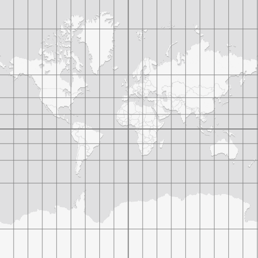
MapTiler Grid schema
The vector tile schema describes how the vector data is organized into different thematic layers and which attribute and values each layer contains. This is useful for writing a map style.
MapTiler Grid is a vector tileset providing global spatial reference layers, including international timezones, UTC offset boundaries, and a standardized WGS84 graticule.
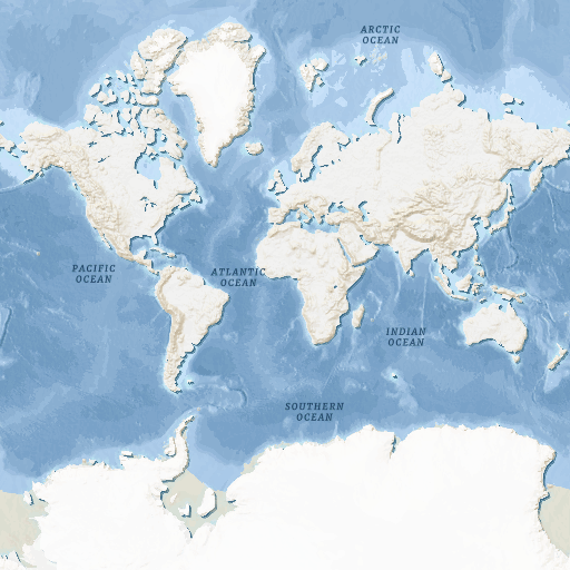
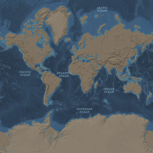
Explore the tileset in the interactive map viewer, check the date of the last update, use it as vector tiles, etc.
Maps with this tileset
Definition of layers
The MapTiler Grid tileset contains the following layers:
dateline #
Layer containing an established navigation boundary located near 180° longitude that serves as the globally recognized demarcation for the transition between calendar days.
Fields
name
Name of the dateline.
Value:
International Date Line
name:{code}
Localized name of the International Date Line in a specific language.
{code} represents ISO 639 language code.
Min zoom:
0
Max zoom:
14 (possible overzooming up to 22)
Unique id
True
grid_wgs_84 #
Layer containing geographic lines - meridians and parallels - with 1 degree step, major circles of latitudes and prime meridians.
Fields
class
Classification category to distinguish between meridians and parallels.
Values:
meridianparallel
degree
Value of latitude (for parallels) or longitude (for meridians).
Min/max values:
-180180
latitude
Classification category to distinguish between northern and southern hemisphere.
Values:
NorthSouth
longitude
Classification category to distinguish between western and eastern hemisphere.
Values:
WestEast
name
Name of major circles of latitudes or prime meridians.
Values:
Antarctic CircleArctic CircleAthensBernBogotaBrusselsCopenhagenEquatorFerroGreenwichJakartaLisbonMadridOsloParisRomeStockholmTropic of CancerTropic of Capricorn
name:{code}
Localized name of the major circles of latitudes or prime meridians in a specific language.
{code} represents ISO 639 language code.
nth_line
Specifies the order of a geographic line.
Values:
151530
Min zoom:
0
Max zoom:
14 (possible overzooming up to 22)
Unique id
True
timezone #
Layer containing timezone boundaries as polygons based on IANA timezone database.
Fields
abbr_sdt
Timezone abbreviation during standard time.
Values:
ACSTAESTAKSTASTAWSTCATCETCSTChSTEATEETESTGMTHKTHSTISTJSTKSTMSKMSTNSTNZSTPKTPSTSASTSSTUTCWATWETWIBWITWITA
abbr_dst
Timezone abbreviation during daylight saving time.
Values:
ACDTADTAEDTAKDTBSTCDTCESTEDTEESTHDTIDTISTMDTNDTNZDTPDTWEST
tz_id
Unique IANA timezone identifier.
Examples:
America/New_YorkEurope/London
utc_offset_sdt
UTC offset in hours during standard time.
Values:
-12-11-10-9.5-9-8-7-6-5-4-3-2.5-2-10+1+2+3+3.5+4+4.5+5+5.5+5.75+6+6.5+7+8+8.75+9+9.5+10+10.5+11+12+13+13.75+14
utc_offset_dst
UTC offset in hours during daylight saving time.
Values:
-12-11-10-9.5-9-8-7-6-5-4-3.5-3-2-10+1+2+3+3.5+4+4.5+5+5.5+5.75+6+6.5+7+8+8.75+9+9.5+10+10.5+11+12+12.75+13+14
Min zoom:
0
Max zoom:
14 (possible overzooming up to 22)
Unique id
True
timezone_label #
Layer containing label points for timezone zones, suitable for placing timezone name labels on a map.
Fields
abbr_sdt
Timezone abbreviation during standard time.
Values:
ACSTAESTAKSTASTAWSTCATCETCSTChSTEATEETESTGMTHKTHSTISTJSTKSTMSKMSTNSTNZSTPKTPSTSASTSSTUTCWATWETWIBWITWITA
abbr_dst
Timezone abbreviation during daylight saving time.
Values:
ACDTADTAEDTAKDTBSTCDTCESTEDTEESTHDTIDTISTMDTNDTNZDTPDTWEST
tz_id
Unique IANA timezone identifier.
Examples:
America/New_YorkEurope/London
utc_offset_sdt
UTC offset in hours during standard time.
Values:
-12-11-10-9.5-9-8-7-6-5-4-3-2.5-2-10+1+2+3+3.5+4+4.5+5+5.5+5.75+6+6.5+7+8+8.75+9+9.5+10+10.5+11+12+13+13.75+14
utc_offset_dst
UTC offset in hours during daylight saving time.
Values:
-12-11-10-9.5-9-8-7-6-5-4-3.5-3-2-10+1+2+3+3.5+4+4.5+5+5.5+5.75+6+6.5+7+8+8.75+9+9.5+10+10.5+11+12+12.75+13+14
Min zoom:
0
Max zoom:
14 (possible overzooming up to 22)
Unique id
True
utc_offset_zone_dst #
Layer containing polygons of UTC timezones based on daylight saving time offset.
Fields
utc_offset
UTC offset in hours.
Values:
-12-11-10-9.5-9-8-7-6-5-4-3-2.5-2-10+1+2+3+3.5+4+4.5+5+5.5+5.75+6+6.5+7+8+8.75+9+9.5+10+10.5+11+12+13+13.75+14
Min zoom:
0
Max zoom:
14 (possible overzooming up to 22)
Unique id
True
utc_offset_zone_label #
Layer containing polygons of UTC timezones based on standard time offset.
Fields
order
Order of the points for given zone from south to north.
Values:
012345678910111213141516171819202122
utc_offset_dst
UTC offset in hours for daylight saving time.
Values:
-12-11-10-9.5-9-8-7-6-5-4-3-2.5-2-10+1+2+3+3.5+4+4.5+5+5.5+5.75+6+6.5+7+8+8.75+9+9.5+10+10.5+11+12+13+13.75+14
utc_offset_sdt
UTC offset in hours for standard time.
Values:
-12-11-10-9.5-9-8-7-6-5-4-3.5-3-2-10+1+2+3+3.5+4+4.5+5+5.5+5.75+6+6.5+7+8+8.75+9+9.5+10+10.5+11+12+12.75+13+14
Min zoom:
0
Max zoom:
14 (possible overzooming up to 22)
Unique id
True
utc_offset_zone_sdt #
Layer containing polygons of UTC timezones based on standard time offset.
Fields
utc_offset
UTC offset in hours.
Values:
-12-11-10-9.5-9-8-7-6-5-4-3.5-3-2-10+1+2+3+3.5+4+4.5+5+5.5+5.75+6+6.5+7+8+8.75+9+9.5+10+10.5+11+12+12.75+13+14
Min zoom:
0
Max zoom:
14 (possible overzooming up to 22)
Unique id
True
languages #
List of possible languages available in MapTiler Grid.
Read more in the article about Change language in a map.
Fields
name:{code}
Localized name of the feature in a specific language.
{code} represents ISO 639 language code.
Values:
am(Amharic)ar(Arabic)az(Azerbaijani)be(Belorussian)bg(Bulgarian)bn(Bengali)br(Breton)bs(Bosnian)ca(Catalan)co(Corsican)cs(Czech)cy(Welsh)da(Danish)de(German)el(Greek)en(English)eo(Esperanto)es(Spanish)et(Estonian)eu(Basque)fa(Persian)fi(Finnish)fr(French)fy(Western Frisian)ga(Irish)gd(Scottish Gaelic)he(Hebrew)hi(Hindi)hr(Croatian)hu(Hungarian)hy(Armenian)id(Indonesian)is(Icelandic)it(Italian)ja(Japanese)ja_kana(Japanese Kana form)ja_rm(romanization of Japanese)ja-Latn(romanisation of Japanese since 2018)ja-Hira(Japanese Hiragana form)ka(Georgian)kk(Kazakh)kn(Kannada)ko(Korean)ko-Latn(romanization of Korean)ku(Kurdish)la(Latin)lb(Luxembourgish)lt(Lithuanian)lv(Latvian)mk(Macedonian)mt(Maltese)ml(Malayalam)nb(Norwegian Bokmål)nl(Dutch)nn(Norwegian Nynorsk)no(Norwegian)oc(Occitan (post 1500))pa(Punjabi)pnb(Western Punjabi)pl(Polish)pt(Portuguese)rm(Romansh)ro(Romania)ru(Russian)sk(Slovak)sl(Slovene)sq(Albanian)sr(Serbian, Cyrillic)sr-Latn(Serbian)sv(Swedish)ta(Tamil)te(Telugu)th(Thai)tr(Turkish)uk(Ukrainian)ur(Urdu)vi(Vietnamese)zh(Chinese)zh-Hant(Traditional Chinese)zh-Hans(Simplified Chinese)
License
With the use of this API, you must visibly credit these attributions: