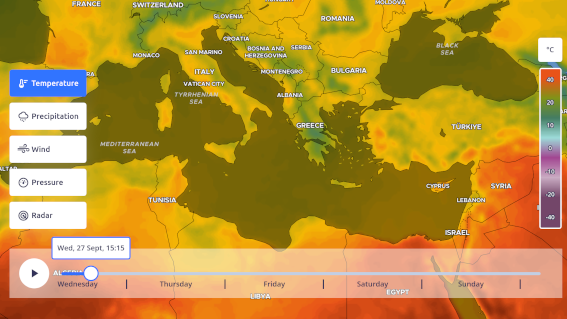
Temperature layer
The TemperatureLayer shows the atmospheric temperature in centigrade (degree Celcius (°C)). Forecast for temperatures at 2 m above ground.

Example
Parameters
Options to provide to the Layer constructor
(TemperatureLayerOptions)
| options.id
default: "MapTiler Temperature"
|
ID of the layer |
|---|---|
| options.colorramp
ColorRamp
default:
ColorRamp.builtin.TEMPERATURE_2 |
Colormap to use. Maximum range possible spans from -127°C to 128°C. Default spans from -70.15°C to 46.85°C |
| options.opacity
default: 1
|
Opacity of the layer in [0, 1] |
| options.smooth
default: true
|
Whether or not the colorramp must be smooth |
Methods
Check out the Layers method reference
Get the temperature in multiple measurement units at a given location
Object: the value(s) as an object.
| value | Temperature in degree Celcius |
|---|---|
| valueImperial | Temperature in degree Farenheit |
Events
Check out the Layers events reference

