MapTiler Server sample package
The MapTiler Server sample package is a free bundle of map designs and data covering the region of Zurich, Switzerland. The sample package is designed to help you try out and start using our map self-hosting solution, MapTiler Server.
What’s inside
The sample package contains a complete set of components for a map self-hosting demo:
- A selection of MapTiler maps for various purposes. Each map is a JSON document that defines what data to show on the map, which dataset to get it from, and how to visually style it. All the maps are customizable.
- The data for the maps, which come in datasets. A single map usually combines multiple datasets such as satellite images, cadastre data, and raster shading to achieve the desired look and level of detail. Even datasets themselves can be combined into a virtual tileset such as MapTiler Satellite which you get with the sample package.
- Offline fonts for the maps.
Current version: 3.15
In the latest version of the sample package, you get these maps:
Each map (except Satellite) is available either as a MapTiler Planet version, which pulls the map data from our professionally maintained MapTiler Planet dataset, or as an OpenStreetMap version which uses the open-source OSM data.
For a complete list and description of the maps and datasets, please refer to the README file included in the sample package.
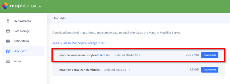
Where to get the package
To get the sample package, go to data.maptiler.com/server and download the maptiler-server-map-styles-and-samples-x.x.zip package. Note that the package is quite large as it contains samples of high-resolution aerial imagery, so the download might take some time.
How to use the package
To upload the sample package to MapTiler Server, drag and drop the downloaded ZIP file to the MapTiler Server interface. For detailed step-by-step instructions, go to Get started with MapTiler Server.
Note for macOS users
At the moment, MapTiler Server doesn’t support rasterization on macOS, so it cannot render maps that use virtual tilesets which combine multiple raster data sources. The Satellite map uses this type of virtual tileset as its data source, which means that MapTiler Server cannot properly serve it on macOS.
To fix the issue, change the data source of the Satellite map to a different tileset. Here’s how:
- In MapTiler Server interface, go to Tiles.
- Find the
maptiler-satelliteJSON file (this is the virtual tileset). Click on the three dots next to it and select Change ID. - Change its default ID “maptiler-satellite” to any other ID and save it.
- Back in Tiles, see what non-virtual satellite tilesets are available—there should be Satellite Lowres and Satellite Mediumres 2021. Choose one of them and change its ID to “maptiler-satellite”.
This replaces the data source of the Satellite map, using the tileset of your choice instead of the default virtual tileset, and the map should now work correctly on Macs.