Enhance coastlines with Land Gradient
Coastline enhancement is a classic cartographic technique used to visually define landmasses and make features stand out in the ocean. You can now easily replicate it with MapTiler and the Land Gradient tileset.

What is a gradient
Let’s start by answering the question of how the effect is actually called. In cartography, we use the term coastal vignette, which means a gradual fade or glow around the coast and blending seamlessly into the background. Graphic designers would call this technique feathering. You can also find the terms Gradient, Blur, or Shading to be used.
In MapTiler, we prepared the tilesets Land Gradient and Land Gradient Dark to be used for this purpose. They use data from the Land tileset, hence the naming. We also use the term gradient to emphasise not only the coastal vignette but also the fading as you approach the poles.

Enhance your map
Coastal vignettes serve multiple purposes in cartography:
- Visual separation: Enhances the distinction between land and water.
- Depth perception: Adds a sense of elevation and layering to the map.
- Historical aesthetics: Mimics classic map styles from the Age of Exploration.
The Land Gradient tileset replicates this effect by applying a soft outer glow around continents. It serves as a modern approach to traditional coastal vignettes, improving visual appeal while maintaining the speed of the MBTiles format.

Using the Land Gradient dataset
The Land Gradient tilesets are available in your Cloud Tiles section where you can preview them.
We use the gradient effect in our Landscape map style where it creates a plastic perception of the continents compared to the ocean. To achieve this effect, the gradient is overlaid with Land, a vector polygon representation of global land areas.
You can reuse this map style or customize it to your preference. We recommend using the following properties:
- Opacity: helps to tune out or enhance the layer across the zoom levels
- Hue shift: makes the gradient a different color
- Saturation shift: turns the gradient monochromatic or more vivid

There is also Landscape Dark available for applications with dark modes, and Landscape Vivid with a vibrant color scheme.
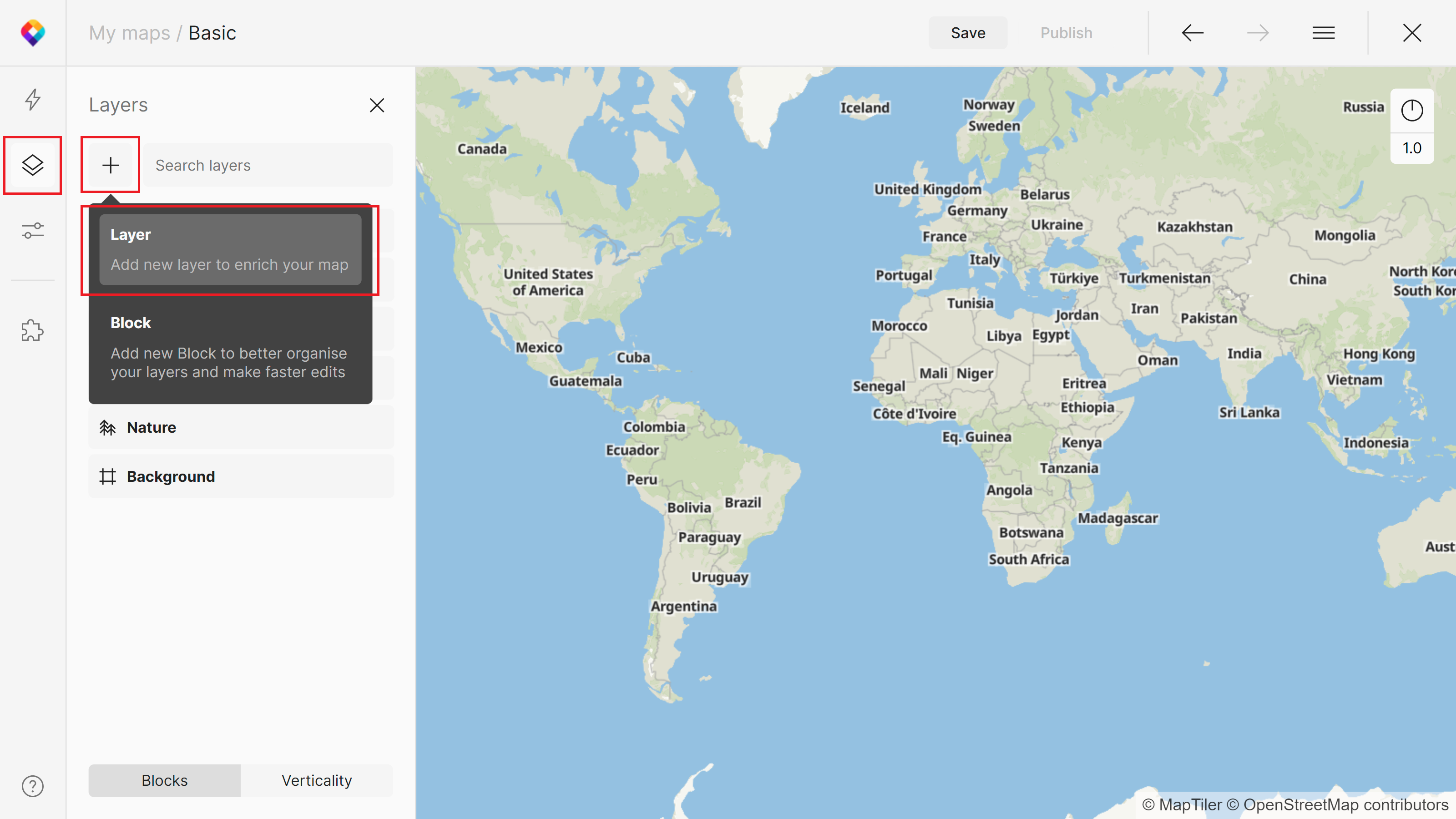
To add the Land Gradient into one of your custom maps, click on the plus button in the left corner of your Layers panel in MapTiler Map Designer (and select Layer).

Search for “Land Gradient” and then click Continue. In the last selection window, you can adjust the Parent Block or Layer name. Once in the map, we recommend moving the gradient down in your Verticality tab. The best position would be just above any water areas.
For more info about how to add and style layers, see Adding a new style layer.