Add features to your dataset
Our vector data editor allows you to add new features to your dataset in several ways. You can either create them manually, search and add, or import from an existing file. This page explains these methods and points you to next steps.
Add features manually
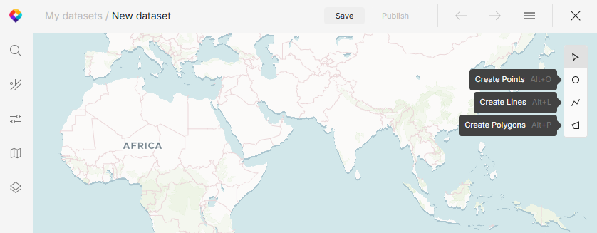
When you open the editor, the tools panel on the right shows that you’re in the select mode. To be able to add features, you need to switch to one of the create modes.

-
In the tools panel, select your mode to create points, lines, or polygons.
-
Click in the map to start drawing. If you’re drawing lines or polygons, each click adds a new point. Double-click to stop drawing.
-
The Features panel opens, showing basic details about the feature you’ve just created. To define custom details, proceed to add feature properties.
Add features via search
In addition to creating geometries from scratch, you can search for existing objects on a map and add the search results as new features. Here’s how to do it:
-
In the left menu, open Search.
-
Type a keyword: name of a city, state, street, etc.
-
Select an item from the search results to see it on the map.
-
Each search result has one or more geometry icons on it, indicating how you can add it. Hover over the icon to show the Add button.
If you save a geometry as a line or polygon, the system automatically calculates its center point and length or area. Alternatively, you can save any line and polygon as its center point only.
-
The name of the feature is added as its property. You can edit it and then add more properties as needed.
Import features from file
To add existing vector features to your working file, import them directly in the editor:
-
Open the menu in the top right corner and select Import data.
-
Choose how to import the new data:
-
Append preserves any features in the working file. You can use this option to merge multiple datasets.
-
Replace deletes all current features before uploading new ones. We recommend saving your file before you do this.
-
What’s next?
You’ve added your features, now you can add feature properties to capture all their details in your dataset.
If you need to change, move or delete any shapes, see how to modify features.